The destination guide
Moab
City in United States, North AmericaUpdated
- Overall9/10
- Best forSolo travelers
- PeakJan–Apr
- CurrencyUSD
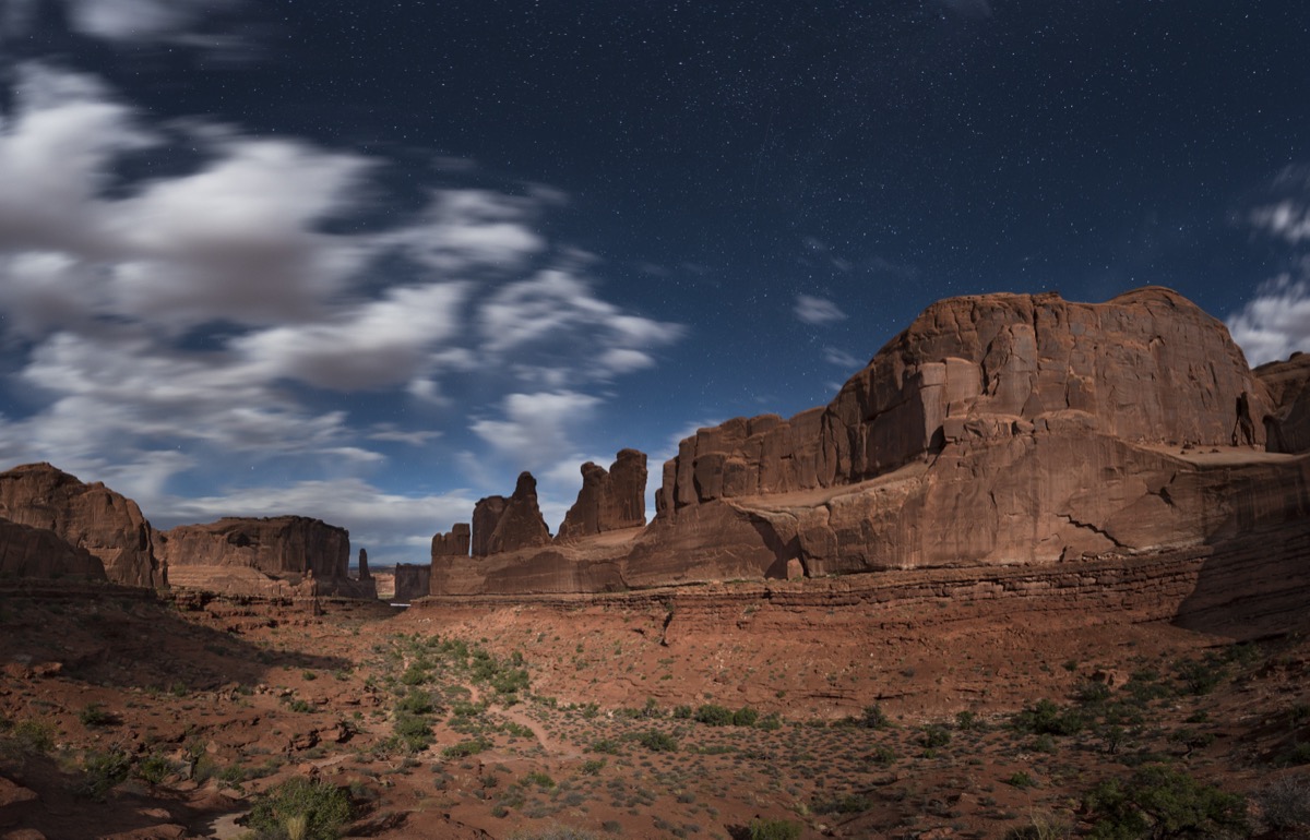
Moab sits in a Utah valley between Arches and Canyonlands — two national parks, the Colorado River, and red rock that changes color every hour of the day.
Travel guides for Moab
Things to do (1)
Where to stay (1)
Food & drink (1)
More guides featuring Moab (13)
At a glance
- English
- Red rock desert
- Arches terrain
- Canyonlands
- Colorado River
How Moab scores
Editorial scores on a 10-point scale, weighed against destinations of the same kind.
Travel safety snapshot
SafePlace indicators use their source 100-point scale; higher is more favourable. Planning context, not a live travel advisory — check official government guidance before you go.
When to go
Best months to visit: February, March, April, May, June, September, October, November and December.
- January: -4 to 5.5 degrees Celsius, 17.5 millimetres of rain, best-time score 3 out of 5.
- February: -1.4 to 9.8 degrees Celsius, 24.3 millimetres of rain, best-time score 4 out of 5.
- March: 3.3 to 15.9 degrees Celsius, 32.3 millimetres of rain, best-time score 5 out of 5.
- April: 7.7 to 21.6 degrees Celsius, 12.3 millimetres of rain, best-time score 5 out of 5.
- May: 13 to 27 degrees Celsius, 9.1 millimetres of rain, best-time score 5 out of 5.
- June: 19.6 to 34.5 degrees Celsius, 3.8 millimetres of rain, best-time score 4 out of 5.
- July: 23.4 to 37.3 degrees Celsius, 3.1 millimetres of rain, best-time score 3 out of 5.
- August: 21.5 to 35.5 degrees Celsius, 9.5 millimetres of rain, best-time score 3 out of 5.
- September: 16.7 to 30.7 degrees Celsius, 11.4 millimetres of rain, best-time score 5 out of 5.
- October: 8.2 to 21.2 degrees Celsius, 31.5 millimetres of rain, best-time score 5 out of 5.
- November: 1.8 to 13.2 degrees Celsius, 20.2 millimetres of rain, best-time score 5 out of 5.
- December: -2.7 to 6.5 degrees Celsius, 21.9 millimetres of rain, best-time score 4 out of 5.
Month-by-month conditions and packing advice
- January
- Cold, mostly dry January in Moab: beauty remains, but extreme heat or winter cold narrows safe outdoor windows. Crowds: January in Moab is workable with normal seasonal planning; build in layers, weather checks, and a mix of indoor and outdoor activities. Pack: Pack warm layers, a coat, and comfortable shoes for cold mornings and evenings.
- February
- Cold, mostly dry February in Moab: conditions can be rewarding if you plan around cold mornings or rising heat. Crowds: February in Moab is workable with normal seasonal planning; build in layers, weather checks, and a mix of indoor and outdoor activities. Pack: Pack warm layers, a coat, and comfortable shoes for cold mornings and evenings.
- March
- Cool to mild, occasional rain March in Moab: mild desert weather supports Arches, Canyonlands, biking, hiking, rafting, and stargazing. Crowds: March in Moab is workable with normal seasonal planning; build in layers, weather checks, and a mix of indoor and outdoor activities. Pack: Pack layered clothing and comfortable walking shoes.
- April
- Mild to warm, mostly dry April in Moab: mild desert weather supports Arches, Canyonlands, biking, hiking, rafting, and stargazing. Crowds: April in Moab is comfortable for sightseeing, neighborhoods, food stops, day trips, and outdoor time with limited weather friction. Pack: Pack layered clothing and comfortable walking shoes.
- May
- Warm to hot, mostly dry May in Moab: mild desert weather supports Arches, Canyonlands, biking, hiking, rafting, and stargazing. Crowds: May in Moab is comfortable for sightseeing, neighborhoods, food stops, day trips, and outdoor time with limited weather friction. Pack: Pack light clothing, sun protection, and comfortable walking shoes.
- June
- Very hot, mostly dry June in Moab: conditions can be rewarding if you plan around cold mornings or rising heat. Crowds: June in Moab can be very hot, so travelers should favor early starts, shaded breaks, indoor attractions, and flexible afternoon pacing. Pack: Pack breathable clothing, strong sun protection, and a refillable water bottle.
- July
- Very hot, mostly dry July in Moab: beauty remains, but extreme heat or winter cold narrows safe outdoor windows. Crowds: July in Moab can be very hot, so travelers should favor early starts, shaded breaks, indoor attractions, and flexible afternoon pacing. Pack: Pack breathable clothing, strong sun protection, and a refillable water bottle.
- August
- Very hot, mostly dry August in Moab: beauty remains, but extreme heat or winter cold narrows safe outdoor windows. Crowds: August in Moab can be very hot, so travelers should favor early starts, shaded breaks, indoor attractions, and flexible afternoon pacing. Pack: Pack breathable clothing, strong sun protection, and a refillable water bottle.
- September
- Warm to hot, mostly dry September in Moab: mild desert weather supports Arches, Canyonlands, biking, hiking, rafting, and stargazing. Crowds: September in Moab is workable with normal seasonal planning; build in layers, weather checks, and a mix of indoor and outdoor activities. Pack: Pack light clothing, sun protection, and comfortable walking shoes.
- October
- Mild to warm, occasional rain October in Moab: mild desert weather supports Arches, Canyonlands, biking, hiking, rafting, and stargazing. Crowds: October in Moab is comfortable for sightseeing, neighborhoods, food stops, day trips, and outdoor time with limited weather friction. Pack: Pack layered clothing and comfortable walking shoes.
- November
- Cool to mild, mostly dry November in Moab: mild desert weather supports Arches, Canyonlands, biking, hiking, rafting, and stargazing. Crowds: November in Moab is workable with normal seasonal planning; build in layers, weather checks, and a mix of indoor and outdoor activities. Pack: Pack warm layers, a coat, and comfortable shoes for cold mornings and evenings.
- December
- Cold, mostly dry December in Moab: conditions can be rewarding if you plan around cold mornings or rising heat. Crowds: December in Moab is workable with normal seasonal planning; build in layers, weather checks, and a mix of indoor and outdoor activities. Pack: Pack warm layers, a coat, and comfortable shoes for cold mornings and evenings.
- March
- February
- January
- April
- September
- August
- July
- June
Know before you go
About
Moab sits in a valley along the Colorado River in southeastern Utah, serving as the gateway to some of the American West’s most spectacular landscapes. The small desert town of 5,000 residents punches far above its weight as an outdoor adventure capital, flanked by two world-class national parks – Arches and Canyonlands – and the dramatic Dead Horse Point State Park. The surrounding landscape is a geologist’s dream of red sandstone fins, natural arches, mesas, buttes, and deep river canyons carved over 300 million years. Once a uranium mining town, Moab reinvented itself as an adventure tourism destination that draws hikers, mountain bikers, rock climbers, river rafters, and 4×4 enthusiasts from around the globe.
Neighbourhoods
Moab’s compact Main Street (Highway 191) serves as the town’s spine, concentrating most restaurants, brewpubs, gear shops, and accommodations within a walkable 1.5-km stretch. The north end of town leads directly to Arches National Park’s entrance, while the south end connects to the Spanish Valley residential areas. The Millcreek neighborhood east of Main Street offers quieter vacation rentals among cottonwoods. Highway 128 (River Road) runs northeast along the Colorado River past wineries, the Sorrel River Ranch, and access to Fisher Towers. The Spanish Trail Arena area south of town hosts off-road events and provides access to the Slickrock Trail. Pack Creek Ranch and the La Sal Mountain foothills offer higher-elevation lodging with cooler temperatures and mountain views. Downtown Moab itself is unpretentious – equal parts bike shop, taco stand, and outfitter, serving the adventure community rather than the resort crowd.
Best time to visit
The best time to visit Moab is spring (March-May) and autumn (September-November), when temperatures hover between 15-27°C (60-80°F) and the desert landscape is at its most photogenic. Spring brings wildflowers to the desert floor while autumn delivers golden cottonwood leaves along the Colorado River. Summer (June-August) can be brutally hot, with temperatures exceeding 40°C (105°F), though early morning and evening adventures remain feasible. Winter (December-February) offers uncrowded trails and potential snow-dusted red rock landscapes, but some trails become icy. Note that Arches National Park requires timed entry reservations April 1-July 6 and August 28-October 31.
Season by season
Spring (March-May):
Weather: 12-27°C, wildflowers bloom, occasional windy days
Highlights: Wildflower season, moderate hiking temps, flowing waterfalls
Best For: Hiking, photography, river trips (spring runoff = bigger rapids)
Summer (June-August):
Weather: 30-42°C, intense sun, monsoon afternoon thunderstorms (July-Aug)
Highlights: Early morning adventures, river floats, dramatic monsoon clouds
Best For: Water activities, dawn/dusk hikes only, stargazing
Autumn (September-November):
Weather: 12-27°C, cottonwood gold along rivers, clear skies
Highlights: Golden cottonwoods along Colorado River, comfortable hiking, smaller crowds (late Oct+)
Best For: Mountain biking, photography, multi-day backcountry trips
Winter (December-February):
Weather: -5 to 10°C, occasional snow on red rock, short days
Highlights: Snow-dusted arches and mesas, virtually empty trails, lower prices
Best For: Solitude, photography of snow-on-red-rock, 4WD exploration
Crowds
Moab experiences peak crowds in spring (March–May) and fall (September–October) for Arches and Canyonlands; quietest in mid-summer (July–August) when heat suppresses visits and in winter (Dec–Feb) with light visitation, but trails can still be busy on weekends.
Getting there and around
Getting there
Canyonlands Field Airport (CNY) lies 27 km north of Moab with daily flights from Denver and Salt Lake City on SkyWest/United. Grand Junction Regional Airport in Colorado (175 km) offers more flight options. Most visitors drive: Salt Lake City is 4 hours northwest via I-15 and US-191, Denver is 5.5 hours east via I-70. The scenic approach on Highway 128 along the Colorado River from I-70 Exit 202 ranks among America’s most dramatic drives. Greyhound buses stop in Green River (80 km) and a local shuttle connects seasonally to Moab.
Getting around
A vehicle is essential in Moab. The distances between Arches National Park (8 km north), Canyonlands Island in the Sky (51 km), and Dead Horse Point (53 km) require driving. High-clearance 4WD vehicles are needed for backcountry roads like the White Rim Trail, Shafer Trail, and some Dead Horse Point access roads. Local outfitters rent Jeeps and off-road vehicles. Within town, Main Street is walkable with restaurants, shops, and bike rental concentrated in a compact stretch. Shuttle services connect to some trailheads during peak season. E-bikes are increasingly popular for in-town transport.
Top experiences in Moab
Arches National Park
Home to over 2,000 natural stone arches – the densest concentration on Earth – this park showcases nature’s sculptural genius across 310 square kilometers of red and orange sandstone. Delicate Arch, a freestanding 16-meter-tall span framing the La Sal Mountains, is Utah’s most iconic landform, reached by a 4.8 km round-trip hike. Landscape Arch stretches 88 meters – the longest in North America. The Devils Garden trail system passes eight named arches in one hike. The Windows section offers drive-up access to massive arches, while the Fiery Furnace slot canyon labyrinth requires a permit or ranger-led tour. As a certified International Dark Sky Park, the Milky Way blazes over the arches on moonless nights.
Canyonlands National Park
Utah’s largest national park encompasses 1,366 square kilometers divided into four distinct districts carved by the Colorado and Green Rivers. Island in the Sky – the most accessible district, 30 minutes from Moab – provides sweeping overlooks from a mesa 300 meters above river canyons, with Grand View Point offering a 160 km panorama. Mesa Arch’s sunrise glow is one of America’s most photographed moments. The Needles district (1.5 hours south) features colorful sandstone spires and backcountry hiking. The remote Maze district requires days of 4WD travel. The 160-km White Rim Trail is a legendary multi-day mountain bike or 4WD route circling below the Island in the Sky.
Dead Horse Point State Park
This state park delivers views often compared to the Grand Canyon from a promontory 600 meters above the Colorado River’s dramatic gooseneck bend – the same viewpoint used in the final scene of the film Thelma and Louise. The overlook requires minimal walking and is easily accessible. A 14.7-mile mountain biking loop traces the rim, and several hiking trails range from easy interpretive walks to longer loops. As a certified International Dark Sky Park, the point offers extraordinary stargazing with zero light pollution. The new Dark Horse Café provides meals with a view. Reservations are recommended for the campground and yurt accommodations.
Colorado River Adventures
The Colorado River through Moab offers rafting experiences for every skill level. Half-day calm-water floats pass through Professor Valley’s towering Fisher Towers and red cliffs, perfect for families. Full-day whitewater trips tackle the rapids of Westwater Canyon. Multi-day expeditions through Cataract Canyon in Canyonlands deliver Class III-IV rapids and wilderness camping on sandy river beaches. Jet boat tours and sunset dinner cruises provide motorized alternatives. Stand-up paddleboarding on calm stretches has become increasingly popular. Local outfitters like Adrift Adventures, Moab Adventure Center, and Tag-A-Long Expeditions provide equipment and expert guides.
Slickrock Mountain Biking Trail
This legendary 19.3-km loop carved across petrified sand dunes of Navajo Sandstone is one of the world’s most famous mountain bike trails. Originally marked in 1969 for motorcycle use, the route became mountain biking’s proving ground as the sport developed in the 1980s. The undulating sandstone provides extraordinary traction, allowing riders to climb and descend impossibly steep pitches while enjoying 360-degree views of the La Sal Mountains, Colorado River valley, and surrounding red rock landscape. A 3.7-km practice loop helps riders gauge their abilities. The trail demands intermediate-to-advanced skills and full-day commitment with plenty of water.
Editor-curated picks carried over from our original guide. Where a full place guide exists, the card links to it.
Worth booking ahead in Moab
Hand-picked from the operators our guides already send readers to. Prices and availability are live on the partner site.
BrowseViator
Tours and tickets in Moab on Viator (opens Viator in a new tab)
Viator's full list of bookable tours and tickets in Moab.
BrowseGetYourGuide
Experiences in Moab on GetYourGuide (opens GetYourGuide in a new tab)
Everything GetYourGuide sells in Moab, with the cancellation terms on each listing.
Where to stayBooking.com
Stays in Moab (opens Booking.com in a new tab)
Live rates and availability for Moab on Booking.com; filter by neighbourhood once you know where your days start.
We earn a commission if you book through these links, at no extra cost to you. It is how we keep the guides free and independent.
Where to stay
Sorrel River Ranch Resort
Mile Marker 17, Highway 128, Moab, UT 84532, USA
This luxury ranch resort occupies 240 acres along the Colorado River surrounded by towering red rock cliffs, accessible via scenic Highway 128. The 55 rooms and suites feature Western-lodge decor with private patios overlooking the river. On-site activities include horseback riding, archery, spa treatments, and a heated pool. The River Grill restaurant serves farm-to-table cuisine with river views. The property provides a secluded contrast to Moab’s busier in-town accommodations, though it’s a 30-minute drive from the parks.
Under Canvas Moab
13784 US-191, Moab, UT 84532, USA
This luxury glamping resort on the doorstep of Arches National Park offers safari-style tents with king beds, private bathrooms, wood-burning stoves, and stunning views of sandstone formations. The camp provides a gourmet communal dining experience, yoga sessions, and stargazing programs that take full advantage of the dark sky setting. Guests enjoy the immersion of camping without sacrificing comfort. The resort operates seasonally (typically March-November) and sells out well in advance for spring and fall weekends.
Hoodoo Moab
71 E 200 S, Moab, UT 84532, USA
This Curio Collection by Hilton property sits at the northern edge of Moab with views of the surrounding canyon country. The contemporary Southwestern design features 97 rooms with local sandstone accents and floor-to-ceiling windows. An outdoor pool and hot tub, fitness center, and the Josie Wyatt’s restaurant (named after a turn-of-the-century local cattle rancher) serve as home base for adventure. The location on Highway 191 provides quick access to Arches National Park’s entrance.
Editor-curated stays carried over from our original guide. Where we have reviewed the hotel, the card links to the review.
Tips from the field
Highlights
- Arches National Park – Over 2,000 natural sandstone arches, including iconic Delicate Arch
- Canyonlands National Park – Vast canyon wilderness with Mesa Arch sunrise and Grand View Point
- Dead Horse Point – 600-meter overlook of the Colorado River gooseneck
- Colorado River Rafting – From calm floats to multi-day whitewater expeditions
- Slickrock Trail – World-famous 19.3 km mountain biking loop
- International Dark Sky Parks – Among Earth's best stargazing locations
- Fisher Towers – Dramatic sandstone spires along scenic Highway 128
- Corona Arch Trail – Free-access arch rivaling Arches NP formations
Best activities
- Moab delivers some of America's most spectacular outdoor experiences concentrated in a compact area. Hike to Delicate Arch in Arches National Park for sunset over Utah's most iconic landmark (4.8 km round trip, bring a headlamp for the walk down). Wake before dawn to photograph Mesa Arch's sunrise glow in Canyonlands' Island in the Sky district. Float the Colorado River through Professor Valley on a half-day raft trip, or tackle Cataract Canyon's whitewater on a multi-day expedition. Mountain bike the legendary Slickrock Trail across petrified sand dunes. Drive to Dead Horse Point at sunset for canyon views rivaling the Grand Canyon. For stargazing, both national parks are certified International Dark Sky Parks – new moon nights reveal a Milky Way so bright it casts shadows.
Local experiences
- Take a sunrise hike to Mesa Arch and watch the canyon country ignite below your feet. Join a half-day Colorado River float to see the Fisher Towers from river level as eagles soar overhead. Rent a mountain bike and ride the Intrepid Trail System at Dead Horse Point for beginner-friendly mesa-top singletrack with canyon views. Explore the petroglyph panels along Potash Road (Highway 279) that ancient peoples carved into the canyon walls. Buy a growler of fresh craft beer from Moab Brewery after a day on the trails. Drive the scenic Highway 128 along the Colorado River at golden hour. Book a ranger-led Fiery Furnace tour to explore the labyrinthine slot canyons that most visitors miss.
Practical tips
- Currency: US Dollar ($). Cards accepted most places; carry cash for some trailhead parking.
- Park Passes: An America the Beautiful annual pass () covers Arches and Canyonlands entrance fees. Otherwise, Arches costs /vehicle and Canyonlands /vehicle. Dead Horse Point is a state park (/vehicle).
- Timed Entry: Arches requires reservations April-July and late August-October (7 AM-4 PM). Book at Recreation.gov up to 6 months in advance.
- Gas: Fill up in Moab – there are no gas stations in the parks and distances are long.
- Sunscreen and Hat: Essential year-round at 1,200m elevation with minimal shade.
- Water: Town tap water is safe but carry extra for adventures. Fill bottles at trailheads where available.
- Dark Sky: Both parks are certified International Dark Sky Parks. New moon periods deliver the best stargazing.
- Cryptobiotic Soil: Never step on the dark crusty soil off-trail – it's a living organism crucial to the desert ecosystem.
Photography tips
- Golden Hour: Mesa Arch at sunrise (arrive 45 min early to claim a spot); Delicate Arch at sunset
- Iconic Shots:
- Mesa Arch sunrise with Canyonlands below – THE Moab photo (tripod recommended)
- Delicate Arch at golden hour from the base viewpoint
- Dead Horse Point gooseneck at sunset or blue hour
- Balanced Rock at night with Milky Way
- Fisher Towers reflections in the Colorado River
- The Windows at sunrise for warm sandstone glow
- Tips:
- A wide-angle lens (16-35mm) is essential for arches and canyon panoramas
- Bring a headlamp for dark-sky photography sessions
- The darkest nights for astrophotography occur during new moon
- Spring and fall provide the best light angles on red rock
- Drone photography is prohibited in all national parks
Timing
- Peak Season (March-May & September-October):
- Best weather for outdoor activities
- MUST book Arches timed entry via Recreation.gov (April-July, late Aug-Oct)
- Accommodations book 3-6 months ahead
- Trails busy but manageable with early starts
- Summer (June-August):
- Dangerous midday heat; plan dawn/dusk activities only
- River activities at their best
- Monsoon season (July-Aug) brings flash flood risk AND dramatic photography
- Lower accommodation prices
- Winter (November-March):
- Lowest prices and fewest visitors
- No timed entry required; enter parks freely
- Some backcountry roads closed by snow
- Snow-on-red-rock creates once-in-a-season photo opportunities
- Key Tips:
- Mesa Arch sunrise: arrive 45 min early or you won't get a spot
- 4WD White Rim Trail permits book months ahead
- Gas up in town – no stations in the parks
- 1L water per hour minimum when hiking
Keeping it authentic
- Moab's authenticity stems from the genuine relationship between its small community and the spectacular landscape. Unlike manufactured resort towns, Moab grew organically from a mining settlement into an adventure hub driven by passionate locals who discovered the recreational potential of their backyard. The town retains a gritty, unpretentious character – Main Street's bike shops, gear outfitters, and brewpubs serve function over form. Local outfitters and guides have been running river trips and 4WD tours for decades, not months. The best experiences happen off the beaten path: ask locals about unmarked petroglyphs, hidden swimming holes, and backcountry routes that don't appear on tourist maps.
Culture, customs and safety
Cultural heritage
The area around Moab holds thousands of years of human history. Fremont and Ancestral Puebloan peoples left petroglyphs and pictographs on canyon walls, including the remarkable panels along Highway 279 (Potash Road) and at Newspaper Rock in the Needles district approach. Spanish explorers crossed the region in the 18th century, followed by Mormon ranchers who settled the valley in the 1850s. The mid-20th century uranium boom transformed the town – Charlie Steen’s Mi Vida mine made millions and the legacy is visible in abandoned mining structures. By the 1980s, mountain biking pioneers discovered Slickrock and launched Moab’s reinvention as an adventure sports capital. Film has also shaped the landscape’s fame, from John Ford Westerns shot in nearby Monument Valley to Thelma and Louise’s final scene at Dead Horse Point.
Local customs & etiquette
Moab’s outdoor culture is built on respect for the land. Never step on cryptobiotic soil crusts (the dark, bumpy biological soil crust that stabilizes desert soils). Pack out all trash, including food scraps and toilet waste in backcountry areas. Stay on marked trails – shortcutting causes erosion that takes centuries to heal. Leave gates as you found them on rural roads. Water conservation is taken seriously in this desert community. The mountain biking community observes strict trail etiquette: hikers have right of way, uphill riders have right of way over downhill. Moab locals are friendly but value the small-town pace; don’t expect big-city speed of service.
Safety notes
Desert safety is paramount in Moab. Carry at least 1 liter of water per hour when hiking and more in summer. Start hikes before dawn in hot months. Dehydration and heat exhaustion are the most common emergencies. Flash flood danger is real in slot canyons and washes – monitor weather forecasts and never enter canyons if rain threatens. The exposed sandstone can be slippery and crumbly; stay on marked trails to protect fragile cryptobiotic soil crusts (the dark, lumpy ground cover that takes decades to form). Cell service is spotty outside town. Emergency: 911.