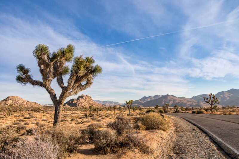


California’s best road trips range from two-day coastal drives to weeklong loops through wine country, redwood forests, Sierra Nevada parks, and desert landscapes. For a first trip, the Carmel-to-Cambria section of Highway 1 is the easiest scenic route to fit into a long weekend. Travelers with a week or more can drive the Pacific Coast Highway from Dana Point to Leggett, follow US-395 from Lone Pine to Lake Tahoe, or connect Sequoia, Kings Canyon, and Yosemite on the Majestic Mountain Loop.
The right route depends on three things: your available days, the season, and current road access. Mountain passes can remain snowbound into late spring, desert heat can make summer travel unsafe, and Highway 1 can close after slides or storms. Distances below are approximate and do not include every detour.
Road-status check: This guide was verified against official sources on August 3, 2026. At that time, Highway 1 was open through Big Sur, with one-way traffic control at Rocky Creek Bridge scheduled through August 31, 2026. Conditions can change quickly, so check Caltrans highway conditions and the relevant park alerts before leaving.
Best California road trips at a glance
| Route | Best for | Approximate distance | Recommended time | Best season |
|---|---|---|---|---|
| 1. San Francisco to Mount Shasta | Volcanic scenery and hiking | About 290 miles one way | 3-5 days | Late spring through fall |
| 2. Napa and Sonoma wine-country loop | Wine, food, and short drives | About 150-220 miles | 2-4 days | Spring or fall |
| 3. Highway 128 to the Mendocino coast | Wine country, redwoods, and small towns | About 170-190 miles | 3-4 days | Spring through fall |
| 4. Eastern Sierra on US-395 | Mountain views and historic sites | About 230 miles one way | 4-6 days | Late spring through fall |
| 5. Sacramento to Eureka | Redwoods and the North Coast | About 350-400 miles | 4-6 days | Late spring through fall |
| 6. Los Angeles to Yosemite | A city-and-national-park trip | About 313 miles one way | 3-5 days | Late spring through fall |
| 7. Majestic Mountain Loop | Three Sierra national parks | About 350-450 miles | 5-7 days | Late spring through fall |
| 8. Rim of the World to Big Bear | A short mountain escape | 110 miles for the full byway | 1-2 days | Year-round, weather permitting |
| 9. Redding-Lassen scenic loop | Volcanic landscapes and lakes | About 170-190 miles | 1-2 days | Summer to early fall |
| 10. Los Angeles to Palm Springs | Desert resorts and modernist architecture | 110 miles direct; longer via Idyllwild | 2-4 days | October through April |
| 11. San Diego to Coachella Valley | Desert parks and small towns | About 250-350 miles | 3-5 days | November through March |
| 12. Dana Point to Leggett on Highway 1 | The full Pacific Coast Highway | More than 650 miles | 7-10 days | Spring or fall |
| 13. Big Sur: Carmel to Cambria | Cliffs, beaches, and short hikes | About 90-100 miles | 2-3 days | Year-round, conditions permitting |
| 14. San Diego to San Francisco coast | A first-time California itinerary | About 600-700 miles | 10 days or more | Spring or fall |
What to check before a California road trip
- Check Caltrans and park road reports twice: once when planning and again within 24 hours of departure. Highway 1, Tioga Road, Generals Highway, and Lassen’s park road are especially sensitive to weather, slides, snow, and construction.
- Reserve scarce access before booking the rest of the itinerary. Campgrounds, Yosemite lodging, Half Dome permits, Hearst Castle tours, and summer vehicle access to Fern Canyon or Gold Bluffs Beach can sell out.
- Plan around seasonal hazards. Carry chains when required in mountain areas, monitor wildfire and smoke conditions in summer and fall, and avoid strenuous desert hiking during extreme heat.
- Refuel before remote sections. Fuel, food, mobile coverage, and restrooms can be limited on Highway 1 in Big Sur, US-395 detours, forest roads near Mount Shasta, and back roads in Anza-Borrego.
- Match the vehicle to the route. Oversized RVs are a poor fit for parts of Generals Highway, Davison Road near Fern Canyon, the Ancient Bristlecone Pine Forest approach, and several narrow coastal roads.
- Use a designated driver in wine country. Winery appointments can be spread across winding rural roads, and tasting portions add up faster than many visitors expect.
An RV can work well on I-5, US-101, and established campgrounds, but it is not automatically the best choice for every route. Review road-length limits and campground dimensions before booking. ViaTravelers’ RV rental guide explains the main tradeoffs.
Northern California road trips
Northern California routes combine long inland valleys, volcanic peaks, wine regions, redwood forests, and a cooler, less developed coastline. The distances can look modest on a map, but mountain roads and two-lane coastal highways often take longer than expected. For a broader regional plan, use our guide to the best things to do in Northern California.
1. San Francisco to Mount Shasta

This route trades San Francisco’s dense city streets for the open Sacramento Valley and the volcanic terrain of the southern Cascade Range. Mount Shasta is a 14,163-foot stratovolcano about 60 miles north of Redding. The drive is roughly five hours without long stops, but three to five days gives you time for Redding, Castle Crags, Mount Shasta City, McCloud, and one or two hikes.
Route and timing
From San Francisco, take I-80 east toward Vacaville, I-505 north, and I-5 north through the Sacramento Valley. This is a more direct and accurate route than the old Highway 8 description. If you have not explored the city first, start with our guides to where to stay in San Francisco and day trips from San Francisco.
A practical three-night plan is Redding on night one, Mount Shasta City or McCloud on nights two and three, then the return drive. Add Castle Crags State Park or Burney Falls only if you have another day; trying to combine every stop turns the trip into a sequence of parking lots.
Best stops
- Walk across Redding’s Sundial Bridge and use the city for groceries, fuel, or an overnight break.
- Hike beneath granite spires at Castle Crags State Park, south of Mount Shasta.
- Visit Mount Shasta City, then drive to Lake Siskiyou, Castle Lake, or McCloud River waterfalls based on road and trail conditions.
- Choose Black Butte Trail only if you are prepared for a steep, rocky 5.1-mile round trip with little shade and no water on the trail.
Know before you go
Snow, wildfire smoke, and forest-road closures can affect this route even when I-5 is open. Check the Shasta-Trinity National Forest conditions before using trailhead roads. Climbing Mount Shasta itself is a mountaineering objective, not a casual extension of a road-trip hike.
2. Napa Valley and Sonoma wine-country loop

Napa and Sonoma work best as a compact road trip with short daily drives, scheduled tastings, and one person who is not drinking. Napa Valley has more than 400 wineries open for tastings, while Sonoma County has more than 425 wineries across a much larger area. The goal is not to visit as many as possible. Two appointments in a day, plus lunch and an unhurried dinner, is a more realistic pace.
Route and timing
From San Francisco, cross the Golden Gate Bridge and use US-101 and CA-37 to reach Sonoma, or take I-80 and CA-29 toward Napa. A useful loop runs through Napa, Yountville, St. Helena, Calistoga, Santa Rosa or Healdsburg, Sonoma Plaza, and back to San Francisco. Silverado Trail offers a calmer alternative to parts of CA-29, but both roads become busy during harvest weekends.
Spend one or two nights in Napa Valley and one in Sonoma County if your budget allows. Our guides to things to do in Napa Valley and things to do in Sonoma cover non-wine options, including art, hiking, spas, and historic town centers.
Best stops
- Walk downtown Napa or Yountville between appointments instead of driving from tasting to tasting.
- Use St. Helena or Calistoga for food, lodging, and access to the northern valley.
- Choose Sonoma Plaza for a walkable cluster of tasting rooms and restaurants.
- Add Healdsburg if you want Russian River, Dry Creek, or Alexander Valley wineries rather than a direct return to San Francisco.
Know before you go
Napa’s harvest season generally runs from August through October and is also a peak visitor period. Reserve tastings well ahead, confirm cancellation policies, and book a driver or tour if everyone in the group plans to drink. Do not assume a winery allows overnight RV parking; use designated campgrounds and RV parks instead.
3. Highway 128 from Winters to the Mendocino coast

California State Route 128 is one of the state’s most varied two-lane drives. It begins near Winters, crosses the hills around Lake Berryessa, passes through Napa Valley and Calistoga, reaches US-101 near Cloverdale, then continues through Anderson Valley and a redwood corridor to Highway 1. Three or four days is enough to experience the route without treating its towns as quick photo stops.
Route and timing
Start in Winters, west of Sacramento, and follow CA-128 toward Lake Berryessa. Continue through Napa County, Calistoga, and Cloverdale. After a short US-101 connection, CA-128 resumes through Yorkville, Boonville, Philo, and Navarro before reaching the coast near the mouth of the Navarro River. Our Sacramento travel guide can help if you are adding a city night before the drive.
Best stops
- Eat or stop for coffee in Winters before the road becomes more rural.
- Choose one Napa Valley stop rather than repeating the separate wine-country loop above.
- Walk among old-growth coast redwoods at Hendy Woods State Park near Philo.
- Drive the 14-mile Navarro River Redwoods State Park corridor where CA-128 follows the river through second-growth redwood groves.
- Finish at Navarro Beach, Albion, or Elk, then continue north to Mendocino if you have an extra night.
Know before you go
The final section is shaded, curving, and slower than the mileage suggests. Coastal fog can reduce visibility, while inland temperatures may be much warmer on the same day. The redwood section is a 14-mile river corridor, not an 11-mile hiking tunnel as the earlier article stated.
California national park and Sierra road trips

California has nine sites with the formal National Park designation: Channel Islands, Death Valley, Joshua Tree, Kings Canyon, Lassen Volcanic, Pinnacles, Redwood, Sequoia, and Yosemite. Sequoia and Kings Canyon are administered together, while Redwood National Park is managed in partnership with three California state parks. Channel Islands requires a boat or flight, so it cannot be driven as part of a conventional road trip.
The routes below focus on parks that connect naturally by road. Check individual park alerts before relying on seasonal roads, trail access, campground availability, or services.
4. Eastern Sierra road trip from Lone Pine to Lake Tahoe
US-395 runs beneath the steep eastern face of the Sierra Nevada and connects desert basins, historic sites, volcanic terrain, alpine lakes, and ski towns. The direct drive from Lone Pine to South Lake Tahoe is about 230 miles, but four to six days is a better pace if you plan to visit Manzanar, Bishop, Mammoth Lakes, Mono Lake, and one or two mountain detours.
Route and timing
Begin in Lone Pine, then follow US-395 north through Independence, Big Pine, Bishop, Mammoth Lakes, Lee Vining, and Bridgeport. Near Topaz Lake, use CA-89 toward South Lake Tahoe when Monitor Pass is open; otherwise continue through the Carson Valley and approach Tahoe on US-50. Late spring through fall offers the widest access, but snow can linger on side roads well after US-395 is clear.
Best stops
- Visit Manzanar National Historic Site between Lone Pine and Independence. More than 10,000 Japanese Americans were incarcerated there during World War II; the visitor center and reconstructed Block 14 provide essential historical context.
- Detour from Big Pine toward the Ancient Bristlecone Pine Forest if the road is open and your vehicle is suitable. Highway 168 is narrow and steep, and the final road to Patriarch Grove is unpaved.
- Use Bishop for fuel and food before driving to Mammoth Lakes. Mammoth Mountain lists more than 3,500 skiable acres and 25 lifts in winter, while summer brings hiking and mountain biking.
- Walk the South Tufa area at Mono Lake Tufa State Natural Reserve to see calcium-carbonate towers formed where freshwater springs interacted with alkaline lake water.
- Finish with an easy beach stop or lakeside walk using our guide to the best beaches in Lake Tahoe.
Know before you go
Do not treat every scenic detour as RV-friendly. The Ancient Bristlecone approach has steep, narrow sections, no potable water at several sites, and weather-dependent access. In winter, carry chains when required and expect some attractions to be inaccessible even if the main highway remains open.
5. Sacramento to Eureka through Clear Lake and the redwoods

A direct Sacramento-to-Eureka drive follows I-5, CA-20, and US-101, but the better road trip adds Clear Lake, Mendocino County, and the Avenue of the Giants. Plan four to six days for a route of roughly 350 to 400 miles, depending on whether you use CA-20 to Fort Bragg and Highway 1 or stay inland until US-101.
Route and timing
Leave Sacramento on I-5 or CA-16 toward Clear Lake. From the lake, take CA-20 west to Willits for the simpler route, or continue to Fort Bragg and follow Highway 1 north to Leggett before joining US-101. The coastal option is slower but adds Mendocino scenery. Continue through Humboldt Redwoods State Park and the Avenue of the Giants before reaching Eureka.
Best stops
- Walk the Indian Nature Trail at Clear Lake State Park, which interprets plants and resources used by Pomo people.
- Add Mendocino or Fort Bragg if you choose the coastal branch of CA-20.
- Drive the Avenue of the Giants through Humboldt Redwoods State Park and stop only in marked pullouts.
- Explore Eureka’s Old Town and use the city as a base; our guide to where to stay in Eureka covers practical options.
- Extend the trip north to Prairie Creek Redwoods State Park if you can add a day.
Know before you go
Summer access to Fern Canyon and Gold Bluffs Beach requires an online day-use reservation from May 15 through September 15. Davison Road does not allow trailers, and motorhomes or other vehicles longer than 24 feet are prohibited. Elk are wild animals; keep your distance and never stop in a traffic lane to photograph them.
6. Los Angeles to Yosemite National Park

This is the strongest California road trip for travelers who want a large city and a major national park in one itinerary. The main route from Los Angeles to Yosemite Valley is about 313 miles and roughly six hours without heavy traffic, meal stops, or entrance delays.
Route and timing
Follow I-5 north, use CA-99 through the Central Valley, then take CA-41 through Fresno and Oakhurst to Yosemite’s South Entrance. Three to five days works if the main goal is Yosemite. Add another day if you want to spend meaningful time in Los Angeles before leaving.
CA-41 is the most dependable year-round approach from Southern California, although winter storms can still require chains. Tioga Road crosses the high country from the east but is seasonal and should not be built into an early-spring itinerary.
Best stops
- Start with one focused Los Angeles day rather than trying to cover the entire city. Santa Monica, Griffith Observatory, or a studio tour each works as a single anchor activity.
- Use Fresno or Oakhurst for groceries and fuel before entering the park.
- In Yosemite Valley, prioritize the Valley Loop, Yosemite Falls, El Capitan Meadow, and viewpoints reachable without a long hike.
- Add Glacier Point only when the road is open and you have enough time to avoid rushing the valley.
Know before you go
Yosemite does not require a vehicle-entry reservation in 2026, but the entrance fee still applies. Lodging and campgrounds should be reserved, and separate permits are required for overnight wilderness trips and the Half Dome cables route. Check the park’s current conditions before departure.
7. Majestic Mountain Loop: Sequoia, Kings Canyon, and Yosemite

The official Majestic Mountain Loop can connect all three parks in as little as three days, but five to seven days is far more useful. The extra time accounts for slow park roads, trail stops, parking, and the long drive between Kings Canyon and Yosemite. The old recommendation to sleep in Lone Pine is geographically impractical because Lone Pine is on the opposite side of the Sierra Nevada.
Route and timing
Use Visalia or Three Rivers for Sequoia, Grant Grove or the Fresno area for Kings Canyon, and Oakhurst for Yosemite’s South Entrance. A sensible order is Sequoia National Park, Kings Canyon National Park, then Yosemite National Park. There is no road across the crest from the Eastern Sierra, so stay on the west side.
Best stops
- Walk the Congress Trail or General Sherman Tree area in Sequoia’s Giant Forest.
- Climb Moro Rock only when conditions are dry and the stairway is open.
- See General Grant Tree in Kings Canyon’s Grant Grove, then drive toward Cedar Grove when the road is seasonally open.
- Give Yosemite at least two nights so the trip does not become a one-day parking exercise.

Know before you go
Generals Highway is steep and tightly curved. Vehicles 22 feet and longer are not advised between Potwisha Campground and Giant Forest Museum, and longer vehicles face additional restrictions elsewhere. No gasoline is sold inside Sequoia and Kings Canyon National Parks, so refuel before entering.
8. Cajon Pass to Big Bear on the Rim of the World Scenic Byway

The Rim of the World Scenic Byway runs 110 miles from Cajon Pass to San Gorgonio Pass using portions of CA-138, CA-18, and CA-38. Big Bear is the most practical overnight base, but the drive also includes Lake Arrowhead, high-elevation overlooks, forest trailheads, and Onyx Summit.
Route and timing
From Cajon Pass, use CA-138 and CA-18 through Crestline and the Lake Arrowhead area, then continue east to Big Bear Lake. Complete the byway on CA-38 toward San Gorgonio Pass, or return the way you came if road conditions make the full loop inconvenient. One night is enough for a scenic drive; two nights gives you time for hiking or winter sports.
Use our guides to things to do in Big Bear and places to visit in Southern California to choose seasonal activities.
Best stops
- Stop at designated overlooks on CA-18 rather than slowing or parking in the traffic lane.
- Walk the Big Bear Lake shoreline or visit the Big Bear Discovery Center.
- Use Cougar Crest Trail for a day hike that connects with the Pacific Crest Trail near Big Bear.
- Continue over Onyx Summit on CA-38 for the full byway experience.
Know before you go
The trail near Big Bear is the Pacific Crest Trail, not the Pacific Coast Trail. Winter weather can require chains even when lower-elevation roads are dry. Check CA-18 and CA-38 conditions before choosing a direction, and do not rely on navigation apps to reroute you onto unmaintained forest roads.
9. Redding-Lassen Volcanic scenic loop

The most useful Redding-to-Lassen route is a loop, not a drive north past Mount Shasta. Take CA-44 east from Redding to Lassen’s northwest entrance, follow CA-89 through the park, then use CA-36 and I-5 to return. The full loop is roughly 170 to 190 miles and works as one long day, although an overnight near the park makes hiking easier.
Route and timing
Start early in Redding and follow CA-44 past Shingletown to Manzanita Lake. When the park highway is fully open, drive its 30-mile length from the northwest entrance to the southwest entrance. Exit on CA-89 and CA-36 toward Red Bluff, then return north on I-5.
Best stops
- Walk the easy Manzanita Lake loop for views of Lassen Peak.
- Stop at the Devastated Area interpretive trail to understand the 1915 eruption.
- See Lake Helen and Sulphur Works from accessible roadside areas.
- Hike Bumpass Hell only when the trail is open and you have adequate water, footwear, and time.
Know before you go
Lassen’s highway usually closes under deep snow and may not fully reopen until late spring or early summer. Burned-area hazards remain after the 2021 Dixie Fire, and seasonal fire restrictions can limit campfires or stove use. Review the official Lassen conditions before driving the loop.
Southern California desert and mountain road trips
Southern California’s best road trips are seasonal. Palm Springs and Anza-Borrego are comfortable in the cooler months, while Big Bear provides a high-elevation escape but can require winter chains. Desert roads also demand more water and a stricter heat plan than coastal itineraries.
10. Los Angeles to Palm Springs, direct or via Idyllwild

The direct drive from Los Angeles to Palm Springs is about 110 miles on I-10 and can take two hours in light traffic or substantially longer on busy weekends. A more scenic version leaves the freeway near Banning, climbs CA-243 to Idyllwild, then follows CA-74 through the San Jacinto Mountains to Palm Desert before continuing to Palm Springs.
Route and timing
Use I-10 for a simple two- to four-day desert break. Choose the Idyllwild and Palms to Pines detour only in daylight and when mountain roads are clear. The detour adds several hours, tight curves, and major elevation changes, so it should replace part of the Palm Springs schedule rather than become a rushed add-on.
Our guide to things to do in Palm Springs covers museums, architecture, hiking, and the aerial tramway, while the Palm Springs restaurant guide helps with evening plans.
Best stops
- Stop in Idyllwild for a walk and lunch if you choose the mountain route.
- Tour Palm Springs’ midcentury neighborhoods with a self-guided route or a local architectural tour.
- Visit the Palm Springs Art Museum, Indian Canyons, or the Palm Springs Aerial Tramway based on weather and mobility needs.
- Add Joshua Tree National Park as a full-day trip, not a quick afternoon diversion. Use our Joshua Tree itinerary to plan the park loop.
Know before you go
October through April is the most comfortable period for outdoor desert activities. Summer heat can make exposed hikes unsafe, while winter storms may bring snow or chain controls to CA-243 and CA-74. Check both desert temperatures and mountain road conditions before choosing the scenic detour.
ViaTravelers also produced a Palm Springs video with additional trip ideas:
11. San Diego to Coachella Valley through Anza-Borrego

The earlier article routed this trip north to Carlsbad and called it a 600-mile drive. A coherent desert itinerary instead travels east from San Diego through Julian and Anza-Borrego Desert State Park, then north past the Salton Sea to the Coachella Valley. Allow three to five days and roughly 250 to 350 miles, depending on side trips.
Route and timing
Drive from San Diego toward Julian on CA-78 or CA-79, descend into Borrego Springs, then continue toward the Salton Sea using CA-78, CA-86, and CA-111. Finish in Palm Desert, Palm Springs, or another Coachella Valley base. A Joshua Tree loop adds a full day and should be planned before the final overnight.
Best stops
- Walk Julian’s compact historic center and stop for lunch before entering the desert.
- Use paved park roads in Anza-Borrego unless you have a suitable high-clearance vehicle, offline maps, recovery equipment, and desert-driving experience.
- See Borrego Springs’ metal sculptures, Palm Canyon area, or roadside badland overlooks based on current access.
- Stop at the Salton Sea only at maintained recreation areas and respect posted closures.
- Finish with Palm Springs or continue to Joshua Tree for Cholla Cactus Garden, Keys View, and a sunset among the boulder fields.
Know before you go
Anza-Borrego summer temperatures can reach 125 degreesF, so this route belongs in the cooler months. The park contains more than 500 miles of dirt roads, and conditions can change after storms. Carry more water than you expect to use and avoid remote roads with one vehicle.
Desert X is not a permanent or annual attraction. The next announced Coachella Valley exhibition runs from October 30, 2027, through May 7, 2028. Check official dates rather than assuming installations will be on view during your trip.
California coastal road trips

California State Route 1 extends for more than 650 miles from Dana Point to Leggett, but it does not stay beside the ocean for every mile. It passes through cities, agricultural areas, redwood country, and sections prone to storm damage. A coastal itinerary should be built around daylight driving, realistic stop times, and a current closure check.
12. Dana Point to Leggett on the Pacific Coast Highway

Dana Point is near Highway 1’s southern terminus, and Leggett is its northern terminus at US-101. Driving the whole route takes more than ten hours without meaningful stops; seven to ten days is the minimum for a vacation rather than an endurance drive. Southbound travel places the ocean-side lane closer to many viewpoints, but northbound travel works well if your flights or other plans make it more practical.
Route and timing
Follow Highway 1 through Orange County, Los Angeles County, the Central Coast, Big Sur, the San Francisco Bay Area, Point Reyes, Mendocino County, and the redwood country near Leggett. In urban areas, Highway 1 may use city streets or run inland. Navigation apps can also push drivers onto US-101 to save time, so review each day’s route before leaving.
Best overnight stops
- Dana Point or Laguna Beach for the first coastal night.
- Santa Monica or Malibu if Los Angeles is part of the trip.
- Santa Barbara, then Pismo Beach or San Luis Obispo.
- Cambria or San Simeon for Cambria attractions and an advance-reserved Hearst Castle tour.
- Big Sur or Monterey, followed by San Francisco.
- Point Reyes or Bodega Bay, then Mendocino or Fort Bragg before Leggett.
Know before you go
Highway 1 was open through Big Sur when this article was checked on August 3, 2026, but one-way traffic control remained at Rocky Creek Bridge through August 31. Recheck Caltrans immediately before the trip. At Pismo State Beach, monarch season generally runs from November through February, and annual counts fluctuate sharply; do not plan around an old fixed butterfly estimate.
Hearst Castle tour times vary by season. Reserve ahead and arrive early enough to collect tickets and board the bus. On cliffside sections, use signed pullouts and never stop partly in a travel lane for a photograph.
13. Big Sur road trip from Carmel to Cambria

Big Sur is the best California road trip for travelers who want maximum coastal scenery in a short distance. The drive between Carmel and Cambria is roughly 90 to 100 miles, depending on the exact endpoints, but viewpoints, state parks, and slow traffic make two or three days worthwhile. Our guide to things to do in Big Sur provides more detail on individual stops.
Route and timing
Start in Monterey or Carmel-by-the-Sea, then drive south so the main ocean pullouts are on your side of the road. Spend one night in Big Sur and a second in Cambria if lodging prices and availability permit. The route can also be driven northbound; safety and road access matter more than direction.
Best stops
- Point Lobos State Natural Reserve for coastal trails before entering Big Sur.
- Bixby Creek Bridge from a legal roadside viewpoint.
- Point Sur State Historic Park when a guided tour fits the published schedule.
- Pfeiffer Big Sur State Park for redwoods and river access.
- McWay Falls overlook at Julia Pfeiffer Burns State Park, subject to trail and parking conditions.
- Ragged Point, San Simeon, and Hearst Castle before reaching Cambria.
Know before you go
Mobile service is unreliable, fuel is limited and expensive, and roadside parking fills early. Download offline maps, keep the fuel tank above half, and avoid scheduling a fixed-time activity immediately after a long Big Sur driving segment. Check both Caltrans and individual state-park pages because an open highway does not guarantee every trail or parking area is open.
14. San Diego to San Francisco: a 10-day coastal road trip

Ten days is enough to connect California’s major coastal cities and Big Sur without driving every day from dawn to dark. This itinerary uses Highway 1 where it adds scenery and US-101 where it reduces slow urban or agricultural miles. Add three to five days if you want to continue north through Mendocino County and the redwoods.
| Day | Overnight | Main plan |
|---|---|---|
| 1 | San Diego | Explore the waterfront, Balboa Park, or one neighborhood rather than crossing the county repeatedly. |
| 2 | Dana Point or Laguna Beach | Drive the Orange County coast and stop at maintained beaches and overlooks. |
| 3 | Los Angeles | Choose Santa Monica, Venice, or another west-side base to reduce traffic before the northbound drive. |
| 4 | Santa Barbara | Follow the coast through Malibu and Ventura; use our guide to things to do in Santa Barbara. |
| 5 | San Luis Obispo or Pismo Beach | Drive the Gaviota coast, stop in a Central Coast town, and visit Pismo’s monarch grove only during its seasonal window. |
| 6 | Cambria or San Simeon | Reserve a Hearst Castle tour and leave time for the coast around Moonstone Beach. |
| 7 | Big Sur | Drive the southern Big Sur section in daylight with a small number of planned stops. |
| 8 | Monterey or Carmel | Finish Big Sur, then visit Point Lobos, Cannery Row, or the Monterey Bay Aquarium. |
| 9 | Santa Cruz or Half Moon Bay | Follow Highway 1 north with stops chosen by weather and available daylight. |
| 10 | San Francisco | Reach the city early enough to return the car or begin a longer stay using our essential San Francisco places guide. |
This schedule deliberately limits each day to one main driving segment and a few substantial stops. For families, compare it with our road trip with kids guide before deciding how often to change hotels.
Which California road trip should you choose?
- Choose Big Sur for a first trip with two or three days.
- Choose US-395 for mountain views, history, and fewer large-city stops.
- Choose Napa and Sonoma for food and wine with short daily drives.
- Choose the Majestic Mountain Loop if national parks are the main purpose of the vacation.
- Choose Palm Springs or Anza-Borrego for a winter road trip with warm daytime weather.
- Choose Dana Point to Leggett when you have at least a week and can remain flexible around Highway 1 conditions.
California road trip FAQ
What is the best road trip in California for first-time visitors?
The Carmel-to-Cambria section of Highway 1 is the best first California road trip for most travelers. It fits into two or three days and combines Big Sur cliffs, short hikes, state parks, Carmel, and Cambria. Check Caltrans before departure because Highway 1 can close after storms or slides.
How many days do you need for a California road trip?
Allow at least three days for one region, seven to ten days for the full Pacific Coast Highway, and ten days or more for a San Diego-to-San Francisco coast itinerary. Driving times are longer than mileage suggests on Highway 1 and in national parks.
Is Highway 1 open through Big Sur?
Highway 1 was open through Big Sur when this guide was checked on August 3, 2026. One-way traffic control remained at Rocky Creek Bridge through August 31, 2026. Conditions can change, so verify the route on the Caltrans road-conditions site immediately before driving.
What is the best month for a California road trip?
May, June, September, and October are strong all-around choices, but the best month depends on the route. Desert trips are better from late fall through early spring, while high Sierra roads may remain closed by snow into late spring or early summer.
Do you need a reservation to enter Yosemite in 2026?
No vehicle-entry reservation is required for Yosemite in 2026, although the entrance fee still applies. Lodging and campgrounds should be reserved, and separate permits are required for overnight wilderness trips and the Half Dome cables route.
Is it better to drive the Pacific Coast Highway north or south?
Southbound driving places the ocean-side lane closer to many coastal viewpoints, but either direction works. Choose the direction that fits your flights, lodging, and road conditions, then use legal pullouts rather than stopping in the travel lane.
Plan the route around the season
Start with one region and one anchor experience per day. Reserve the scarce items first, keep the remaining stops flexible, and check road conditions again the day before driving. California’s most satisfying road trips leave time for a trail, a town, or an unexpected closure without forcing the rest of the itinerary to collapse.
Plenty of people arrive in California by car rather than starting there. the Minnesota to California drive covers the approach from the Upper Midwest through Zion and Las Vegas.
For more ideas beyond the routes above, see our guide to the best things to do in California and our comparison of Northern California versus Southern California.