

Route 66 is famous because it compressed several defining American stories into one road: Dust Bowl migration, wartime mobilization, postwar family travel, independent roadside businesses, and the promise—and limits—of personal mobility. Books, music, television, and films then turned that history into an international symbol of the open road.
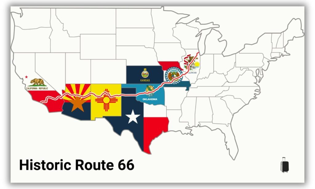
Designated in 1926, historic U.S. Highway 66 linked Chicago with Los Angeles and was later extended to Santa Monica. It became fully paved in 1938, was replaced in stages by the Interstate Highway System, and was decommissioned in 1985. Much of the old corridor remains accessible today as local roads, state highways, scenic byways, and signed historic alignments.
- Established: November 11, 1926
- Conventional length: about 2,448 miles, although the mileage changed as alignments moved
- States: Illinois, Missouri, Kansas, Oklahoma, Texas, New Mexico, Arizona, and California
- Historic endpoints: Chicago and Los Angeles; the route was extended to Santa Monica in 1936
- Current status: decommissioned as a U.S. highway, but many historic sections remain drivable
Why Route 66 became famous
No single event made Route 66 famous. Its reputation accumulated over six decades as travelers used the road for survival, work, commerce, military logistics, and vacations. The highway also ran through town centers rather than bypassing them, placing diners, gas stations, motor courts, neon signs, and roadside attractions directly in a traveler’s path.
| Reason | Why it mattered |
|---|---|
| Migration and opportunity | Route 66 gave Dust Bowl families and other westbound travelers a direct corridor toward California. |
| Military and industrial movement | During World War II, the road carried military equipment, troops, and workers heading to western defense industries. |
| Roadside business culture | Independent motels, diners, filling stations, repair shops, and novelty attractions created a recognizable style of American car travel. |
| Books, music, television, and film | The Grapes of Wrath, Bobby Troup’s song, the 1960s television series, and Pixar’s Cars carried the road’s name far beyond the United States. |
| Loss and preservation | Interstate bypasses damaged many route-dependent communities. The effort to preserve surviving buildings and road segments strengthened Route 66’s nostalgic appeal. |
A short history of Route 66
1926: A new number joined older roads
Route 66 was one of the original highways in the U.S. numbered highway system. It was not a newly built, federally owned superhighway. The route joined existing local, state, and national roads into a marked corridor from Chicago through St. Louis to Los Angeles. The U.S. Highway 66 Association promoted it aggressively and pressed for improvements and paving.
That diagonal course connected large cities with farming communities, mining towns, and small commercial centers across the Midwest, Great Plains, Southwest, and Southern California. Businesses along the road quickly recognized that passing motorists needed fuel, repairs, meals, and places to sleep.

1930s: Migration gave the road a deeper meaning
During the Great Depression and Dust Bowl, families from the Great Plains traveled west in search of work and stability. The Library of Congress identifies Route 66 as a direct pre-Interstate route from the Dust Bowl region to California’s Central Valley.
John Steinbeck’s 1939 novel The Grapes of Wrath made this migration story widely known and popularized the nickname the Mother Road. The phrase captured the road’s role as a lifeline, but the journey it described was often marked by poverty, discrimination, and disappointment rather than carefree adventure.

1940s and 1950s: War traffic gave way to vacation traffic
World War II reduced ordinary leisure travel but increased the highway’s strategic value. Route 66 moved troops and supplies between military installations and carried workers toward defense plants in California and the Pacific Northwest. After the war, automobile ownership and leisure travel expanded, and families used the route to reach cities, national parks, Southern California beaches, and new attractions such as Disneyland.

1956–1985: Interstate highways bypassed the Mother Road
The Interstate Highway System offered faster, limited-access travel. Five Interstates—I-55, I-44, I-40, I-15, and I-10—replaced U.S. 66 in stages. The last section was bypassed in 1984, and Route 66 was removed from the U.S. highway system in 1985.
The new roads saved time for through traffic but often redirected customers away from old business districts. Motels, gas stations, cafes, and shops closed in many bypassed communities. That economic rupture is central to Route 66’s modern appeal: travelers are not only following an old road but also visiting places that survived a major change in how Americans moved.
The freedom story was not equal for everyone
Route 66 is often described as a symbol of freedom, but that freedom was constrained by segregation. Black motorists could face discrimination, denial of service, or physical danger while looking for food, fuel, and lodging. Victor H. Green’s annual travel guide—published from 1936 to 1964 and commonly called the Green Book—listed businesses where Black travelers could stop more safely.
The National Park Service’s Route 66 Green Book research documents both the risks travelers faced and the Black-owned businesses that served them. Including this history does not weaken Route 66’s meaning. It makes the story more accurate by showing who could access the road’s celebrated promise—and under what conditions.
12 verified facts about Route 66
1. Route 66 was one of the original U.S. numbered highways
The route received its official designation in 1926 as part of the new U.S. numbered highway system. It combined existing roads rather than beginning as a single new federal construction project. This distinction matters because the familiar Route 66 corridor always contained different road types, owners, surfaces, and later realignments.
2. Its famous 2,448-mile length is an approximation
The conventional end-to-end figure is about 2,448 miles, while the National Park Service often rounds the corridor to 2,400 miles. Both can be reasonable because Route 66 changed alignments in several states. There is no single mileage that describes every version of the highway between 1926 and 1985.
3. Route 66 crossed eight states
From east to west, the highway passed through Illinois, Missouri, Kansas, Oklahoma, Texas, New Mexico, Arizona, and California. It began in Chicago. The original western terminus was in Los Angeles, and the route was extended to Santa Monica in 1936.
4. It became fully paved in 1938
Route 66 did not open as an uninterrupted ribbon of pavement. Early motorists encountered gravel, dirt, and other road surfaces. Advocacy and construction eventually made it the first U.S. highway to be completely paved, according to the Federal Highway Administration’s Route 66 fact sheet.
5. The road has three enduring nicknames
The Mother Road is associated with Steinbeck’s The Grapes of Wrath. Main Street of America reflects the route’s path through community business districts. Will Rogers Highway honors the Oklahoma-born humorist and performer. Each name emphasizes a different part of the road’s identity: migration, commerce, and regional culture.
6. Promotion helped create the legend
The U.S. Highway 66 Association did more than advocate for paving. It marketed the corridor as an appealing Chicago-to-Los Angeles route and encouraged motorists to use it. Route 66’s fame was therefore partly planned: a strong number, organized promotion, memorable roadside signs, and business participation gave the highway a coherent identity long before modern destination branding.
7. It was a military transport corridor during World War II
Route 66 helped move military equipment, troops, and supplies across the country and connected installations in the Southwest and California. It also carried workers toward western defense industries. The accurate claim is that the highway supported wartime mobilization—not that one road alone determined the outcome of the war.
8. Route 66 helped shape roadside architecture and fast dining
Because the highway passed through towns, owners competed for motorists’ attention. Neon signs, themed motor courts, giant objects, unusual buildings, drive-in service, and quick roadside meals became part of the route’s visual language. Route 66 did not single-handedly invent fast food or the American roadside attraction, but it became one of their most visible stages.


9. Bobby Troup wrote the Route 66 song in 1946
Bobby Troup composed “(Get Your Kicks on) Route 66” in 1946. The King Cole Trio, led by Nat King Cole, first recorded it that year. Chuck Berry, the Rolling Stones, and many other artists later recorded versions, helping the highway’s name travel internationally.

10. Television and Cars renewed its cultural reach
The television drama Route 66 ran from 1960 to 1964 and linked the road’s name with youthful movement and discovery. Decades later, Pixar’s 2006 film Cars introduced the story of bypassed highway towns to a new generation. Pixar says its team took research trips along Route 66 before creating Radiator Springs, while the National Park Service identifies Peach Springs, Arizona, as one of the inspirations for the fictional community.
This cultural afterlife matters because it turned historic preservation into something emotionally legible: the decline of Radiator Springs mirrors the economic shock that many real towns experienced when Interstate traffic moved elsewhere.
11. Petrified Forest is the only national park with a Route 66 segment
Petrified Forest National Park preserves traces of the old roadbed, historic telephone poles, and a 1932 Studebaker display. The park is the only U.S. national park that contains a segment of Route 66, although many other National Park Service sites lie on or near the broader corridor.

12. Route 66 is celebrating its centennial in 2026
The Route 66 Centennial is being marked throughout 2026 with events, preservation projects, exhibits, and state-level programs. Congress created the 15-member Route 66 Centennial Commission through legislation signed in 2020. Travelers should use the official Route 66 Centennial calendar for current event information rather than relying on a single festival schedule.

Preservation continues beyond the anniversary. The National Park Service Route 66 Corridor Preservation Program supports research, planning, education, and the protection of significant road segments, buildings, structures, and cultural landscapes.

Can you still drive Route 66 today?
Yes, you can drive much of historic Route 66, but not as one continuous federal highway. Some sections became frontage roads or state and local routes, some were absorbed into Interstate corridors, and others are closed, unpaved, abandoned, or on private land. Signage also varies by state and community.
Use a Route 66-specific guide and the National Park Service interactive map rather than asking a standard navigation app to route you from Chicago to Santa Monica. The NPS warns that historic-route signs and cellular coverage can be limited in places.

How much time should you allow?
For a first end-to-end trip, 10 to 14 days is a practical planning range. Seven days is possible, but it produces long driving days and leaves less time for museums, historic motels, local restaurants, detours, and conversations with the people preserving the road. A two- or three-week trip allows a slower pace and more side trips.
Before departure, verify seasonal weather, road closures, attraction hours, lodging availability, and desert driving conditions. Carry water, download offline maps, and review a dependable list of road trip essentials. Families may also want to adapt these family road trip planning ideas for shorter driving blocks.
A practical state-by-state route overview
| State | Representative Route 66 places | Planning note |
|---|---|---|
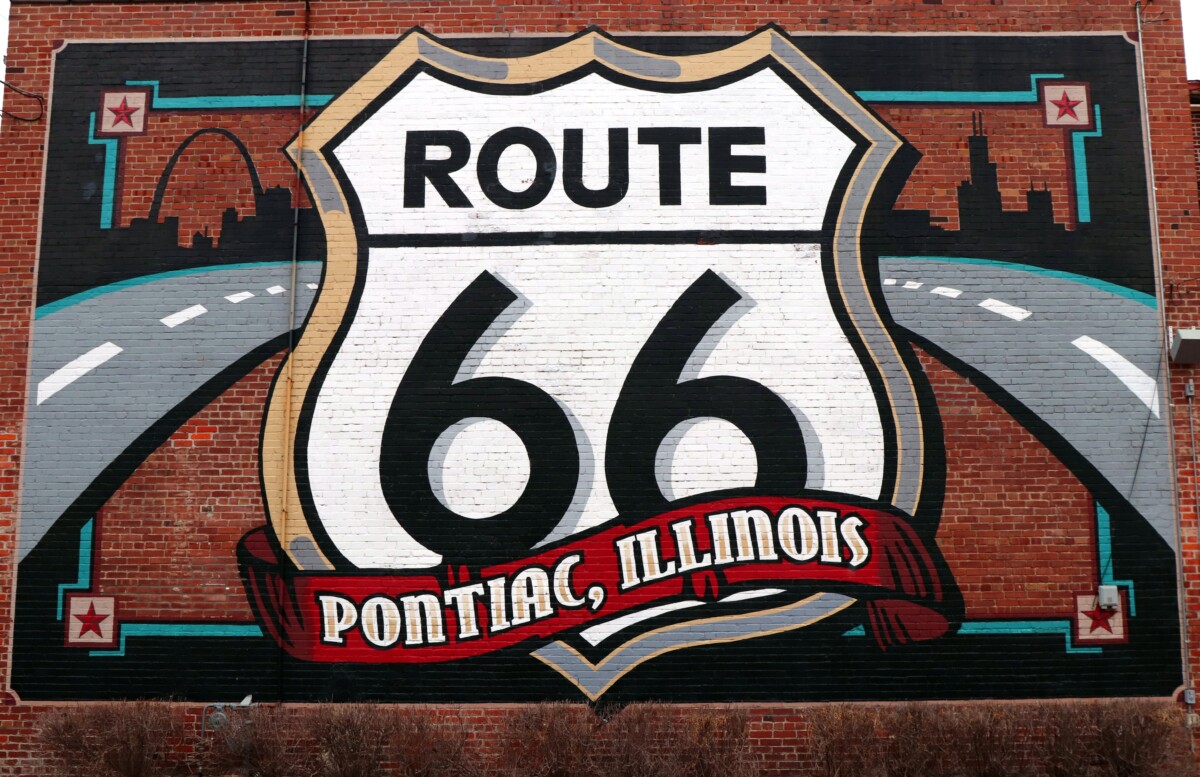
| Illinois | Downtown Chicago, Joliet, Pontiac, Springfield | Urban streets and well-marked historic sections make Illinois a useful introduction to the route. |
| Missouri | St. Louis, Cuba, Lebanon, Springfield | Expect Ozark scenery, historic motor courts, caves, and several old alignments. |
| Kansas | Galena, Riverton, Baxter Springs | The Kansas section is short, but it preserves strong mining-town and roadside history. |
| Oklahoma | Tulsa, Arcadia, Oklahoma City, Clinton | Oklahoma contains a large concentration of historic pavement, museums, and roadside architecture. |
| Texas | Shamrock, Amarillo, Cadillac Ranch, Adrian | The Texas Panhandle brings long horizons, preserved neon, and the route’s geographic midpoint area. |
| New Mexico | Tucumcari, Santa Fe, Albuquerque, Gallup | Multiple historic alignments require careful mapping; choose deliberately between the Santa Fe and later alignments. |
| Arizona | Petrified Forest, Winslow, Flagstaff, Seligman, Kingman | Allow time for preserved town centers and a possible Grand Canyon side trip. |
| California | Needles, Amboy, Barstow, San Bernardino, Los Angeles, Santa Monica | Desert sections can be remote and extremely hot; finish with the urban corridor to the Pacific and compare nearby West Coast road trip stops. |
For a more detailed stop list, use our guide to the best Route 66 attractions. You can also compare the trip with other classic U.S. road trips before committing to an end-to-end drive.
Frequently asked questions
Why is Route 66 famous?
Route 66 is famous for carrying Dust Bowl migrants, military traffic, postwar vacationers, and generations of road trippers between Chicago and Southern California. Independent motels, diners, neon signs, books, music, television, and film turned that history into a global symbol of the American open road.
Where does Route 66 start and end?
Historic Route 66 starts in Chicago, Illinois. Its original western endpoint was Los Angeles, but the highway was extended to Santa Monica in 1936. Modern travelers commonly treat Santa Monica as the end of the route.
Can you still drive all of Route 66?
You can drive much of Route 66, but not as one continuous federal highway. Some sections are local roads or frontage roads, while others are abandoned, closed, unpaved, or inaccessible. Use a Route 66-specific map and verify local conditions.
Why is Route 66 called the Mother Road?
John Steinbeck popularized the name Mother Road in his 1939 novel The Grapes of Wrath. The phrase described Route 66 as the main westward corridor used by displaced Dust Bowl families seeking work in California.
When was Route 66 decommissioned?
Route 66 was officially decommissioned in 1985 after five Interstate highways replaced it in stages. Historic sections survived under state and local control, and many are now marked as Historic Route 66 or designated scenic byways.
How long should a Route 66 road trip take?
Ten to 14 days is a practical first-trip range for driving from Chicago to Santa Monica while stopping at museums, historic towns, diners, and roadside attractions. A week is possible but rushed; two or three weeks allows a slower pace and more detours.
Why Route 66 still matters
Route 66 remains important because it preserves more than a nostalgic road-trip image. Its surviving pavement, businesses, signs, and communities show how the automobile changed migration, military logistics, commerce, architecture, leisure, and daily life. The road also exposes the gap between the national promise of mobility and the unequal realities many travelers faced.
Driving it today is less about completing a perfect line on a map than about paying attention: to older town centers, locally owned businesses, altered landscapes, and the people keeping the corridor’s history visible. That combination of movement, memory, loss, and reinvention is the clearest answer to why Route 66 is still famous.

History and route status last fact-checked in August 2026. Road access, business hours, event schedules, and weather conditions can change; verify local information before travel.