
The best road trips in the United States combine distinctive scenery, worthwhile stops, realistic daily mileage, and a route that is practical to drive. The Blue Ridge Parkway is a strong first weeklong trip, Route 66 is the classic multiweek journey, Utah’s Mighty Five is the leading national-park circuit, the Overseas Highway works well for a short warm-weather escape, and the Pacific Coast route offers the broadest range of coastal landscapes.
This guide compares 20 U.S. road trip routes by distance, ideal trip length, season, road conditions, and primary appeal. The numbering is for navigation rather than an absolute ranking. A 50-mile alpine road and a 3,000-mile cross-country route solve very different travel problems.
This update uses current information from the National Park Service, state transportation agencies, tribal park authorities, official tourism organizations, and existing ViaTravelers route photography. For additional options, compare these scenic road trips across the United States.
Planning details last verified: July 22, 2026. Road openings, reservations, fees, wildfire restrictions, and construction can change quickly. Recheck the linked official road or park page immediately before departure.
Quick picks: which U.S. road trip should you choose?
- Best first weeklong road trip: Blue Ridge Parkway
- Best classic cross-country trip: Historic Route 66
- Best national-park circuit: Utah’s Mighty Five
- Best ocean-focused journey: Pacific Coast route
- Best short tropical drive: Overseas Highway
- Best high-alpine roads: Going-to-the-Sun Road and Beartooth Highway
- Best fall drives: North Shore Scenic Drive, Skyline Drive, Blue Ridge Parkway, and the Maine coast
Compare the best road trips in the United States
| Road trip | Approximate distance | Ideal trip length | Best season | Best for |
|---|---|---|---|---|
| Historic Columbia River Highway | 70 miles | 1-2 days | Spring or fall | Waterfalls and historic road design |
| Independence Pass | 32 miles | 1 day | Summer to early fall | High-alpine scenery |
| Utah’s Mighty Five | About 450-550 miles | 7-10 days | Spring or fall | National parks and desert hiking |
| Pacific Coast route | 1,500+ miles | 10-21 days | Late spring or early fall | Coastlines, redwoods, and ocean towns |
| Historic Route 66 | About 2,400 miles | 14-21 days | Spring or fall | Roadside history and Americana |
| Arkansas Scenic 7 | 290 miles | 2-4 days | Spring or fall | Ozark and Ouachita scenery |
| Road to Hana | 52 miles one way | Full day or overnight | Drier periods | Rainforest, waterfalls, and coastal views |
| Olympic Peninsula Loop | About 330 miles | 3-5 days | Summer or early fall | Coast, rainforest, and mountains |
| Great River Road | 3,000-mile route network | 10-21 days | Spring or fall | River towns and American history |
| U.S. Route 50 | About 3,000 miles | 14-21 days | Late spring or fall | Cross-country variety and remote landscapes |
| North Shore Scenic Drive | 154 miles | 2-4 days | Summer or fall | Lake Superior and waterfalls |
| Los Angeles to Las Vegas on I-15 | About 270 miles | 1-3 days | Fall through spring | Desert stops and city contrast |
| Parks Highway | About 362 miles | 3-5 days | June to early September | Alaska scenery and Denali access |
| Maine coast to Acadia | About 175-250 miles | 3-5 days | Early summer or fall | Harbors, lighthouses, and Acadia |
| Overseas Highway | 113 miles | 2-4 days | Winter or spring | Ocean bridges and island stops |
| Going-to-the-Sun Road | 50 miles | Full day | Summer | Glacier National Park’s alpine terrain |
| Blue Ridge Parkway | 469 miles | 5-7 days | Late spring or fall | Mountain overlooks and relaxed driving |
| Beartooth Highway | About 68 miles | Full day | Summer | High-elevation switchbacks and Yellowstone access |
| Monument Valley Scenic Drive | 17 miles | 2-4 hours | Spring or fall | Navajo landscapes and sandstone buttes |
| Skyline Drive | 105 miles | 1-2 days | Spring or fall | Shenandoah overlooks and wildlife |
20 best road trips in the United States
1. Historic Columbia River Highway, Oregon

Route: Troutdale to The Dalles. Distance: 70 miles. Ideal trip: 1-2 days. Best time: spring or fall. Best for: waterfalls, historic engineering, and a short Oregon road trip.
The Historic Columbia River Highway was designed as a scenic road rather than a fast transportation corridor. From the Portland area, it climbs to viewpoints above the Columbia River Gorge before passing basalt cliffs, forests, and a concentrated series of waterfalls.
Allow at least three to five hours for the drive itself and considerably longer if you stop for walks. Crown Point, the waterfall corridor, Hood River, Mosier, and Rowena Crest give the route enough substance for an overnight trip rather than a rushed out-and-back drive.
Spring generally produces stronger waterfall flow, while fall offers drier conditions and changing leaves. Winter storms can make the narrow road hazardous. Check the official TripCheck byway page before leaving, then build the route into a longer stay using these things to do in Portland and the broader Oregon travel guide.
2. Independence Pass, Colorado

Route: Twin Lakes to Aspen on Colorado Highway 82. Distance: 32 miles. Ideal trip: 1 day. Best time: summer through early fall. Best for: a dramatic paved drive across the Continental Divide.
Independence Pass crosses 12,095 feet and includes steep grades, tight curves, exposed drop-offs, and several narrow sections. The summit pullout provides broad views of the Sawatch Range, while the eastern and western approaches pass lakes, forest, and alpine terrain.
The pass normally opens near Memorial Day after snow removal and closes again in late fall, but the exact dates depend on weather. Commercial and recreational vehicles with a combined length of 35 feet or more are prohibited. Drivers who are uncomfortable meeting oncoming traffic on narrow mountain roads should choose another route or approach the summit only from the side they find manageable.
Review the latest Colorado Department of Transportation notice before departure. The drive pairs well with a longer itinerary built from these Colorado travel ideas.
3. Utah’s Mighty Five national parks

Route: Zion, Bryce Canyon, Capitol Reef, Canyonlands, and Arches. Distance: roughly 450-550 miles before local park driving. Ideal trip: 7-10 days. Best time: spring or fall. Best for: national parks, hiking, geology, and night skies.
Utah’s Mighty Five is a park circuit rather than a single highway. A practical west-to-east route begins at Zion, continues to Bryce Canyon and Capitol Reef, and finishes around Moab for Canyonlands and Arches. Reversing the order works equally well for travelers arriving from Colorado.
Seven days is enough for the primary overlooks and several short hikes, but ten days gives the route a better rhythm. Canyonlands requires particular planning because its districts are not connected by roads. For a first visit, Island in the Sky is the easiest district to combine with Arches and Moab.
Spring and fall usually offer the most manageable temperatures. Summer heat can restrict hiking in the lower desert parks, while Bryce Canyon and other high-elevation areas can receive snow well beyond midwinter. Check the National Park Service’s Utah park pages for current shuttles, road work, campground rules, and alerts.
Use the ViaTravelers guides to compare more places to visit in Utah, prepare for a Zion National Park visit, or expand the drive with a Grand Circle road-trip itinerary.
4. Pacific Coast route, California to Washington

Route: California State Route 1 and U.S. 101 through California, Oregon, and Washington. Distance: 1,500 miles or more, depending on endpoints. Ideal trip: 10-21 days. Best time: late spring or early fall. Best for: ocean cliffs, beaches, redwood forests, and coastal towns.
The Pacific Coast journey is not one continuous highway. A coherent long-form itinerary uses California State Route 1 through areas such as Malibu, Big Sur, and San Francisco, then follows U.S. 101 through Northern California’s redwoods, the Oregon coast, and Washington’s Olympic Peninsula.
The drive rewards a slower schedule. California’s cliffs and urban traffic, Oregon’s beaches and headlands, and Washington’s forests each justify several days. Trying to cover all three states in one week turns a scenic trip into a sequence of long driving days.
2026 access note: Highway 1 reopened through Big Sur on January 14, 2026. As of July 22, one-way traffic controls and construction delays remained at several points. Check the live Caltrans Highway 1 report before committing to reservations that depend on through access.
For regional alternatives, compare these West Coast trip ideas and shorter California road-trip itineraries.
5. Historic Route 66, Illinois to California
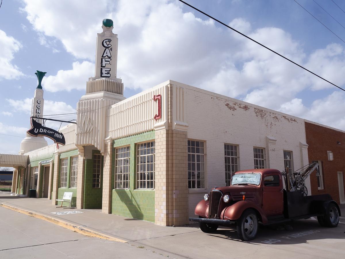
Route: Chicago to Santa Monica. Distance: about 2,400 miles. Ideal trip: 14-21 days. Best time: spring or fall. Best for: roadside history, small towns, diners, motels, and classic American driving culture.
Historic Route 66 crosses Illinois, Missouri, Kansas, Oklahoma, Texas, New Mexico, Arizona, and California. The federal highway was officially decommissioned in 1985, so today’s trip follows a patchwork of preserved alignments, local roads, business loops, and signed historic sections rather than one uninterrupted modern highway.
Two weeks provides enough time for the major cities, museums, neon signs, trading posts, desert landscapes, and roadside architecture. Three weeks is more comfortable if you want to speak with business owners, visit local museums, or add side trips to places such as the Grand Canyon.
Use a current Route 66 map instead of relying on a standard navigation app, which may place you on the nearest interstate. Seasonal businesses can have limited hours, particularly outside summer. The National Park Service provides useful background on the route’s decommissioning and preservation.
For deeper planning, read why Route 66 became famous and compare notable Route 66 attractions.
6. Arkansas Scenic 7 Byway
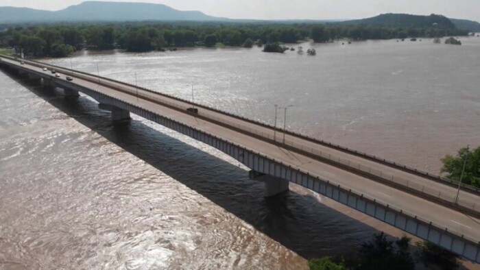
Route: North-to-south across Arkansas on Highway 7. Distance: 290 miles. Ideal trip: 2-4 days. Best time: spring or fall. Best for: Ozark roads, forest, rivers, mountain towns, and a quieter regional trip.
Arkansas Scenic 7 crosses four of the state’s geographic regions, moving from the Ozarks through the Arkansas River Valley and Ouachita Mountains before reaching the pine country of southern Arkansas. The road changes character several times, which gives the relatively compact route more variety than its mileage suggests.
Jasper and the Buffalo River area work well for the northern portion. Hot Springs is the most practical longer stop in the center, while the southern section passes smaller communities and forested countryside. Two days covers the route at a driving-focused pace; three or four allow time for trails, overlooks, and town stops.
The mountain sections contain sustained curves, so drive them in daylight and avoid building an itinerary around aggressive arrival times. Review the official Arkansas Scenic 7 overview before selecting overnight stops.
7. Road to Hana, Maui

Route: Kahului or Paia to Hana on highways 36 and 360. Distance: about 52 miles one way from Kahului. Ideal trip: a full day or an overnight stay. Best time: a relatively dry day with an early start. Best for: rainforest, waterfalls, coastal views, and a slow technical drive.
The Hana Highway contains 620 curves and 59 bridges. The distance is short, but the narrow road, one-lane bridges, traffic, and frequent stops make it an all-day journey. Keanae Peninsula, roadside waterfalls, Waianapanapa State Park, and Hana itself are more useful anchors than trying to stop at every pullout.
Waianapanapa uses advance parking and entry reservations, which can be booked up to 30 days ahead. Secure a time slot before building the day around the park. Do not stop on bridges, block residents’ driveways, enter private property, or assume that an unpaved continuation beyond Hana is permitted by a rental agreement.
Leave early, allow faster local traffic to pass at legal pullouts, and stay overnight if you want time in Hana without driving back in darkness. Consult the official Hana travel information and the Waianapanapa reservation system.
8. Olympic Peninsula Loop, Washington

Route: A U.S. 101 loop around the Olympic Peninsula, with spur roads into Olympic National Park. Distance: about 330 miles before park detours. Ideal trip: 3-5 days. Best time: summer or early fall. Best for: rainforest, Pacific beaches, glacial lakes, and mountain roads.
U.S. 101 circumnavigates the peninsula, but it does not pass through the center of Olympic National Park. Major destinations such as Hurricane Ridge, the Hoh Rain Forest, Sol Duc, Rialto Beach, and Lake Quinault require separate spur drives. That layout makes the route longer and slower than a map initially suggests.
A practical circuit includes Port Angeles, Lake Crescent, Forks, the Hoh area, one or two Pacific beaches, and Lake Quinault. Three days covers the highlights with limited walking. Four or five days gives you room for weather changes and avoids stacking several long park spurs into one day.
Road status varies significantly. Some park roads are narrow, gravel, unsuitable for RVs, or temporarily closed after washouts and construction. Consult the Olympic National Park road-status page before departure.
Use the ViaTravelers Hoh Rain Forest guide for one of the loop’s main stops, then compare other Washington State trip ideas.
9. Great River Road, Minnesota to the Gulf of Mexico

Route: A signed network following the Mississippi River through 10 states. Distance: approximately 3,000 miles. Ideal trip: 10-21 days for a long section or full journey. Best time: spring or fall. Best for: river towns, music, food, civil-rights history, Indigenous history, and changing regional landscapes.
One more belongs on any list like this. the Great River Road runs the length of the Mississippi through ten states, and the Minnesota and Wisconsin bluff sections are the prettiest.
The Great River Road is not one federal highway. It is a network of signed state and local roads following the Mississippi from northern Minnesota to the Gulf of Mexico. That structure lets travelers choose scenic river roads instead of staying on the fastest interstate.
The full route is most rewarding when divided into regional chapters. An Upper Mississippi trip can include Lake Itasca, Minneapolis and St. Paul, the Driftless Area, and St. Louis. A Lower Mississippi route can connect Memphis, the Delta, Natchez, Baton Rouge, and New Orleans.
Travelers with one week should choose one region instead of attempting the entire corridor. River flooding, levee work, and local construction can affect the signed route, so check each state’s road information as the trip approaches. The Federal Highway Administration’s Great River Road page provides an official overview.
For a northern route, compare these Minnesota road trips. The guide to things to do along the Mississippi River adds stop ideas farther south.
10. U.S. Route 50, Ocean City to Sacramento

Route: Ocean City, Maryland, to Sacramento, California. Distance: approximately 3,000 miles. Ideal trip: 14-21 days. Best time: late spring or fall. Best for: a continuous cross-country highway with cities, plains, mountains, desert, and long remote sections.
U.S. Route 50 is less curated than Route 66. It is an active highway that moves between urban streets, rural two-lane roads, divided highways, mountain passes, and desert basins. Its appeal comes from the continuity of crossing the country rather than a consistent roadside theme.
The route begins on Maryland’s Atlantic coast, passes through Washington, D.C., crosses the Appalachians and Midwest, continues through the Great Plains and Rocky Mountains, and reaches California after the deserts of Utah and Nevada. Great Basin National Park is a useful Nevada-area side trip, but it adds time and should not be treated as a brief roadside stop.
Services become sparse in the West, and mountain weather can affect the Colorado, Nevada, and California portions. Carry a fuel buffer, download offline maps, and check each state’s 511 service instead of assuming one national source will capture every closure.
At the western endpoint, use this guide to plan things to do in Sacramento.
11. North Shore Scenic Drive, Minnesota

Route: Duluth to Grand Portage using old Highway 61 and Minnesota Highway 61. Distance: 154 miles. Ideal trip: 2-4 days. Best time: summer or fall. Best for: Lake Superior, waterfalls, cliffs, lighthouses, and small harbor towns.
The North Shore Scenic Drive begins with the old Highway 61 section between Duluth and Two Harbors, then follows Highway 61 northeast beside Lake Superior. The route is compact, but the concentration of state parks, waterfalls, short trails, and shoreline stops makes a one-day drive feel unnecessarily rushed.
A useful three-day plan gives Duluth and Two Harbors the first day, Gooseberry Falls and Split Rock Lighthouse the second, and the stretch through Tettegouche, Lutsen, and Grand Marais the third. Add Grand Portage or the Gunflint Trail if you have a fourth day.
Watch: driving Minnesota’s North Shore
Fall color can be excellent, but popular weekends bring heavier traffic and limited lodging. Winter is possible for properly equipped drivers, although snow, wind, ice, and short daylight hours change the character of the trip.
Plan the route with the Minnesota North Shore guide, things to do in Duluth, and things to do in Grand Marais. Two defining stops are Split Rock Lighthouse and Gooseberry Falls State Park. Explore Minnesota also maintains an official scenic-drive overview.
12. Los Angeles to Las Vegas on I-15

Route: Los Angeles to Las Vegas on Interstate 15. Distance: about 270 miles. Ideal trip: 1-3 days. Best time: fall through spring. Best for: desert scenery, roadside stops, and two major entertainment cities.
The direct drive takes roughly four to five hours without substantial traffic, but congestion leaving Los Angeles or returning from Las Vegas can add several hours. The route becomes more interesting when it is treated as a desert itinerary rather than a race between two cities.
Potential stops include Calico Ghost Town, Baker, a detour into Mojave National Preserve, and Seven Magic Mountains south of Las Vegas. These stops can turn the drive into a one-night trip without requiring a complicated route.
Summer temperatures can be dangerous. Carry water, keep the fuel tank above one-quarter full, and do not rely on a mobile phone as the only emergency tool. Check Caltrans QuickMap and Nevada road conditions before departure.
Use the drive as a bridge between a weekend in Los Angeles and these things to do in Las Vegas. After arrival, decide whether you need a car in Las Vegas before paying for several days of hotel parking.
Vegas is the stop where a road-trip budget usually breaks. It does not have to – our list of free and cheap things to do in Las Vegas covers the Bellagio Conservatory, Seven Magic Mountains and the free shows on the Strip.
13. Parks Highway, Alaska

Route: Anchorage to Fairbanks on Alaska Route 3. Distance: about 362 miles. Ideal trip: 3-5 days. Best time: June through early September. Best for: Alaska Range views, Talkeetna, Denali access, wildlife, and long summer daylight.
The George Parks Highway is the primary paved road between Anchorage and Fairbanks. A standard rental car is generally sufficient for the highway in summer. It should not be confused with the Denali Highway, a separate, mostly gravel route that may have different rental restrictions.
Talkeetna makes a practical first stop, followed by one or more nights near Denali National Park. Nenana can break up the final section to Fairbanks. Three days covers the corridor at a basic pace; five days provides meaningful time around Denali.
2026 Denali access note: Denali Park Road remains closed at Mile 43 because of the Pretty Rocks landslide. During the summer bus season, private vehicles are normally restricted beyond Savage River at Mile 15, and transit or tour buses travel no farther than the East Fork Bridge at Mile 43. Review the current Denali conditions and reserve a bus well ahead of a peak-season visit.
Continue planning with these places to visit in Alaska, a detailed Denali National Park itinerary, and the Denali packing list.
14. Maine coast to Acadia National Park

Route: Portland to Bar Harbor and Acadia National Park, primarily using U.S. 1 and coastal detours. Distance: roughly 175-250 miles. Ideal trip: 3-5 days. Best time: early summer or fall. Best for: working harbors, historic towns, lighthouses, seafood, and Acadia.
The direct Portland-to-Bar Harbor drive can be completed in several hours, but that misses the reason to follow the coast. A better itinerary gives time to places such as Bath or Brunswick, the Boothbay region, Rockland, Camden, Penobscot Bay, and Mount Desert Island.
Three days works for a selective route. Five days gives you room for coastal detours and a full day in Acadia. Fog and rain can reduce visibility even in summer, while popular fall weekends bring heavy traffic and high lodging demand.
2026 reservation note: A vehicle reservation is required to drive Cadillac Summit Road from May 20 through October 25, 2026. The reservation costs $6 and is separate from the park entrance pass. Vehicles over 21 feet, RVs, and trailers are prohibited on the summit road. Confirm details through the official Cadillac Summit Road reservation page.
Acadia also appears in the ViaTravelers guide to the best national parks in the United States.
15. Overseas Highway, Florida Keys

Route: Key Largo to Key West on U.S. 1. Distance: 113 miles. Ideal trip: 2-4 days. Best time: winter or spring. Best for: ocean bridges, snorkeling stops, island towns, and warm-weather driving.
The Overseas Highway crosses 42 bridges as it links the Upper, Middle, and Lower Keys. Although the direct drive can take only a few hours in light traffic, treating it as a short island itinerary produces a much better trip.
Key Largo works well for diving and snorkeling, Islamorada for an overnight stop or meal, Marathon for the central Keys, Bahia Honda for beach time, and Key West for at least one full day. Mile markers are the primary local reference points, so note the relevant numbers for accommodations and stops.
U.S. 1 is the only road in and out of most of the Keys, which makes it vulnerable to peak-period congestion, crashes, severe weather, and evacuation traffic. Travel outside Friday and Sunday rush periods when possible. During the Atlantic hurricane season, monitor official forecasts and local emergency guidance.
The official Florida Keys site explains the Highway That Goes to Sea and current transportation considerations. Pair the drive with a Key West day-trip guide or a longer stay using these things to do in Miami.
16. Going-to-the-Sun Road, Montana
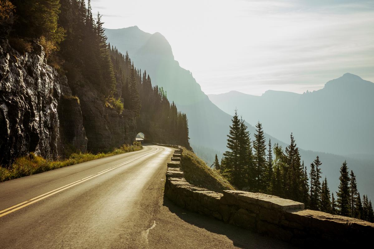
Route: West Glacier or Apgar to St. Mary through Glacier National Park. Distance: 50 miles. Ideal trip: 1 full day. Best time: the summer period when the full road is open. Best for: alpine scenery, glacial lakes, hiking access, and a landmark mountain road.
Going-to-the-Sun Road climbs from Lake McDonald through forest and steep mountain terrain to Logan Pass before descending toward St. Mary Lake. Two hours is a reasonable no-stop estimate, but a full day is more realistic once viewpoints, trailheads, traffic, and parking are considered.
The full opening date changes each year because crews must remove deep snow and address rockfall. Never build a late-spring itinerary around an assumed opening. Vehicles and combinations longer than 21 feet or wider than 8 feet are prohibited between Avalanche Creek and Rising Sun, and vehicles over 10 feet high can encounter rock-overhang problems.
2026 access note: Vehicle reservations are not required in 2026. From July 1 through September 7, Logan Pass has a three-hour parking limit. A ticketed shuttle is available for travelers who need longer access. Review the official Going-to-the-Sun Road page and the 2026 Logan Pass guidance.
Use these guides to compare other places to visit in Montana, the best national parks in the United States, and worthwhile U.S. hiking trails.
17. Blue Ridge Parkway, Virginia to North Carolina
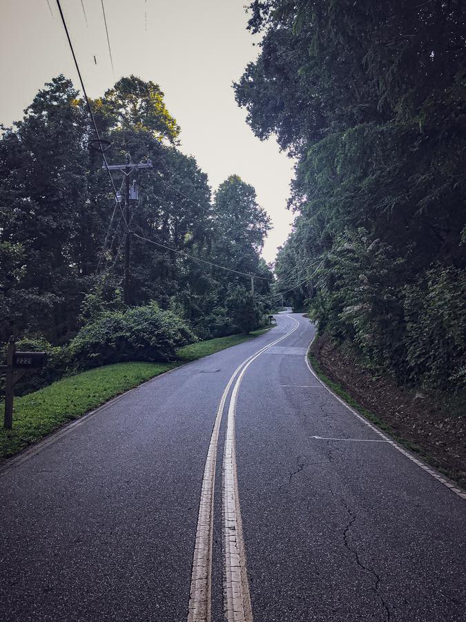
Route: Rockfish Gap, Virginia, to Cherokee, North Carolina. Distance: 469 miles. Ideal trip: 5-7 days. Best time: late spring or fall. Best for: mountain overlooks, short hikes, cultural sites, and relaxed driving.
The Blue Ridge Parkway connects Shenandoah National Park with Great Smoky Mountains National Park. It is designed around the driving experience, with frequent overlooks, picnic areas, trailheads, historic sites, and access to Appalachian communities.
Five days provides a workable end-to-end trip, while seven days allows meaningful stops at Humpback Rocks, Peaks of Otter, Mabry Mill, the Blue Ridge Music Center, Linn Cove Viaduct, Craggy Gardens, and the Mount Mitchell area. Travelers with less time should select one section rather than spending most of the trip moving between overnight stops.
Services can be limited directly on the parkway, so refuel before long sections and carry food and water. Ice, fallen trees, fog, construction, and storm recovery can close individual segments.
2026 access note: Multiple areas remain affected by construction, bridge work, and Hurricane Helene recovery. Check the daily Blue Ridge Parkway road-status page rather than assuming an end-to-end route is open.
Compare the route with other scenic road trips across the United States, nearby national parks, and the best U.S. hiking trails.
18. Beartooth Highway, Montana and Wyoming

Route: Red Lodge to Cooke City and Yellowstone’s northeast entrance on U.S. 212. Distance: about 68 miles. Ideal trip: 1 full day. Best time: summer. Best for: high-elevation switchbacks, alpine lakes, tundra, and Yellowstone access.
Beartooth Highway climbs rapidly from Red Lodge into the Beartooth Mountains, crosses terrain above 10,000 feet, and descends toward Cooke City. The short mileage understates the time needed because the road contains sustained grades, switchbacks, viewpoints, and fast-changing weather.
The highway is generally open from the Friday of Memorial Day weekend through mid-October, weather permitting. Snow and severe weather can still produce temporary summer closures. Carry warm layers even when conditions in Red Lodge are mild.
Fuel before leaving Red Lodge or Cooke City, and avoid placing a fixed Yellowstone tour or flight immediately after the drive. Check the Montana Department of Transportation’s Beartooth page and Yellowstone alerts before departure.
Extend the trip with these places to visit in Montana and a practical Yellowstone itinerary.
19. Monument Valley Scenic Drive, Arizona and Utah
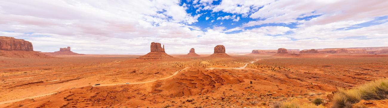
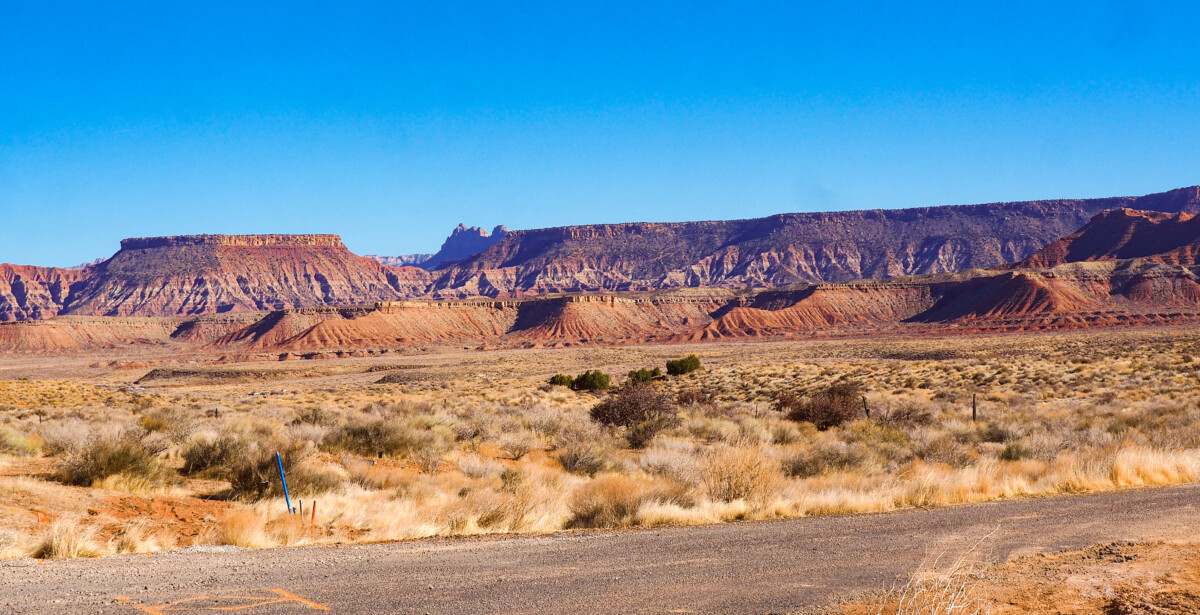
Route: The self-drive loop inside Monument Valley Navajo Tribal Park. Distance: 17 miles. Ideal trip: 2-4 hours. Best time: spring or fall. Best for: sandstone buttes, desert photography, Navajo culture, and a short unpaved drive.
The loop begins near the visitor center and passes formations including the East and West Mitten Buttes, Merrick Butte, John Ford’s Point, the Totem Pole, and Artist’s Point. The route lies on Navajo Nation land and should be approached as a tribal park rather than a standard federal or state scenic road.
The road is unpaved and can contain deep sand, ruts, rocks, and washboard surfaces. Motorcycles and RVs are prohibited on the loop. Travelers with low-clearance rental cars, mobility concerns, or limited rough-road experience may find a Navajo-guided tour more appropriate.
Weather can change road conditions quickly, and hours, fees, or last-entry times may change. Review the official Monument Valley Navajo Tribal Park page, follow all posted rules, and do not enter restricted or backcountry areas without authorization.
For a broader regional itinerary, compare these Southwestern vacation destinations.
20. Skyline Drive, Virginia
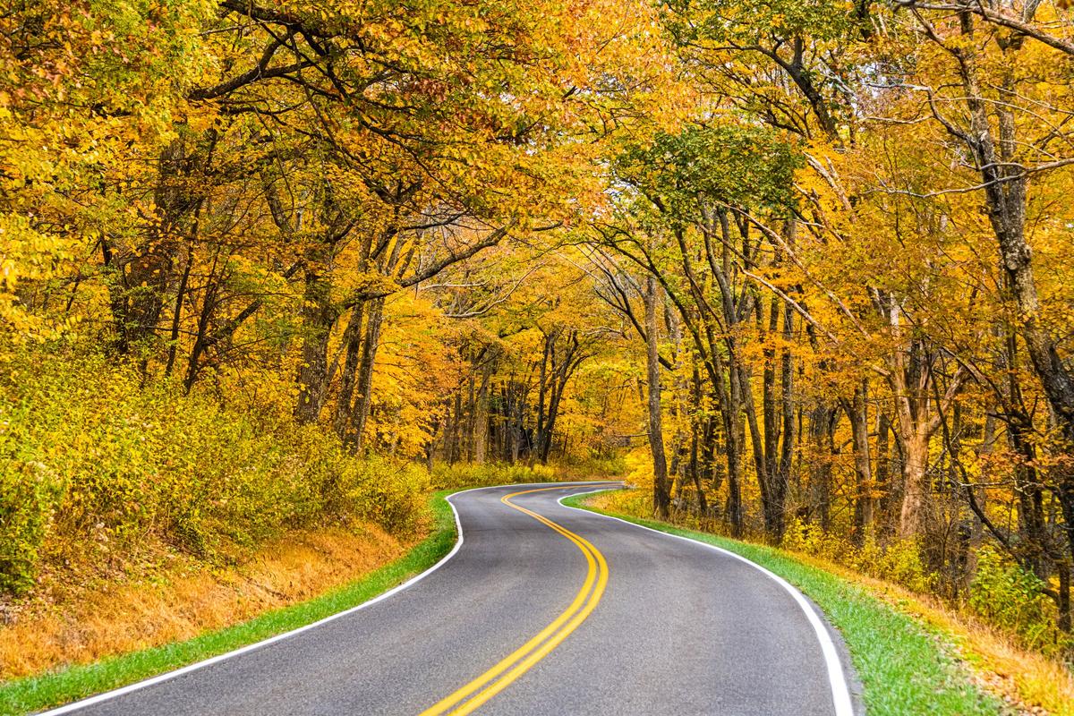
Route: Front Royal to Rockfish Gap through Shenandoah National Park. Distance: 105 miles. Ideal trip: 1-2 days. Best time: spring or fall. Best for: accessible mountain overlooks, wildlife, short hikes, and a compact national-park road trip.
Skyline Drive follows the crest of the Blue Ridge Mountains and is the only public road running the length of Shenandoah National Park. It takes about three hours to drive without extended stops, but the 35-mph speed limit and more than 75 overlooks make a full day more realistic.
Front Royal is the northern entrance, while Rockfish Gap connects directly with the Blue Ridge Parkway. Travelers can also enter at Thornton Gap or Swift Run Gap, making it easy to drive only one section. The central portion works well for visitors pairing overlooks with a short waterfall or ridge hike.
Wildlife frequently crosses the road, and fog, ice, snow, high winds, or fallen trees can trigger closures. Check the official Skyline Drive guidance before entering the park.
Continue planning with the ViaTravelers Virginia travel guide.
How to choose the right U.S. road trip
Start with the time available, not the route’s reputation. A short itinerary can be excellent when the daily mileage leaves room for the places that made you choose the road in the first place.
- For one to three days: Historic Columbia River Highway, Independence Pass, Road to Hana, Los Angeles to Las Vegas, Going-to-the-Sun Road, Beartooth Highway, Monument Valley, or Skyline Drive.
- For four to seven days: Olympic Peninsula, North Shore Scenic Drive, Maine coast, Overseas Highway, or a selected Blue Ridge Parkway section.
- For one to three weeks: Utah’s Mighty Five, Pacific Coast, Route 66, Great River Road, U.S. Route 50, or Alaska’s Parks Highway with a longer Denali stay.
- For a relaxed first trip: Choose a route with regular services and several exit points, such as the Blue Ridge Parkway, Maine coast, Overseas Highway, or North Shore.
- For remote driving: U.S. Route 50, Parks Highway, Beartooth Highway, and parts of the Great River Road require more fuel, weather, and communication planning.
How to plan a road trip in the United States
- Set a realistic daily driving limit. Four to six hours is usually enough on a scenic trip. Mountain roads, urban traffic, park shuttles, and photo stops make map estimates unreliable.
- Choose the vehicle after choosing the route. A large RV cannot use every road in this guide. Independence Pass prohibits vehicles and combinations of 35 feet or more, Going-to-the-Sun Road has a 21-foot length limit on its central section, and Monument Valley prohibits RVs on the loop. Review these restrictions before renting an RV.
- Check constrained-access sites before booking lodging. Examples include Waianapanapa State Park, Cadillac Summit Road, Logan Pass shuttle tickets, and Denali buses.
- Download offline maps. Cell service is unreliable in many national parks, mountain passes, forests, deserts, and rural river corridors. Save official maps and essential reservation details locally.
- Plan fuel and charging stops. Do not assume every rural gas station operates late or every charger is functional. EV drivers should use this guide to planning an electric-vehicle road trip.
- Reserve fewer nonrefundable nights. Keep at least one flexible day on a long itinerary for weather, construction, fatigue, or a place that deserves more time.
- Budget by day and category. Separate lodging, fuel, park fees, food, parking, and activities instead of relying on one total number. These strategies can help you save money for travel without cutting essential safety costs.
- Adapt the schedule for children. Shorter driving blocks, predictable meal stops, and outdoor breaks are more effective than asking children to tolerate a full adult itinerary. See the guide to road trips with kids.
Road-trip safety and seasonal access checks
Inspect tires, brakes, lights, fluids, wipers, the battery, and the spare-tire equipment before a long drive. Check the vehicle identification number for unresolved safety recalls. A rental car should still receive a basic visual inspection before leaving the lot.
Fatigue is a serious road risk. Stop when concentration drops, avoid driving through normal sleeping hours, and switch drivers when possible. Caffeine cannot reliably replace sleep.
- Carry drinking water, food, weather-appropriate clothing, a flashlight, charging cables, a power bank, and a basic first-aid kit.
- Keep the fuel tank above one-quarter full in remote areas.
- Never drive around a closure gate or barrier, even when a navigation app shows the road as open.
- Slow down for wildlife, cyclists, pedestrians, road crews, and stopped traffic near viewpoints.
- Follow tribal regulations and remain on authorized roads in Navajo Nation and other sovereign tribal lands.
- Store valuables out of sight and review these travel security products only after identifying the actual risks of your route.
Use the National Highway Traffic Safety Administration’s road-trip checks, its guidance on drowsy driving, and the National Park Service’s Ten Essentials as practical preparation references.
Frequently asked questions
What is the best road trip in the United States for first-time visitors?
The Blue Ridge Parkway is a strong first weeklong route because it has frequent access points, established towns nearby, moderate daily mileage, and many overlooks. Route 66 is better for travelers with two or three weeks.
How long do you need for a U.S. road trip?
Allow three to five days for a regional route, seven to ten days for a multi-park or multistate circuit, and at least two weeks for Route 66, U.S. Route 50, or a long Pacific Coast journey.
What is the best U.S. road trip for one week?
The Blue Ridge Parkway fits a relaxed five-to-seven-day trip. Utah’s Mighty Five also works in one week, but the pace is faster and leaves less time for long hikes.
Which U.S. road trips are best in fall?
Strong fall options include the Blue Ridge Parkway, Skyline Drive, Minnesota’s North Shore, the Maine coast, Arkansas Scenic 7, and the Historic Columbia River Highway.
Which scenic roads close in winter?
Independence Pass, Going-to-the-Sun Road, and Beartooth Highway have major seasonal closures. Snow, ice, wind, or fallen trees can also close sections of Skyline Drive and the Blue Ridge Parkway.
Do you need an SUV for these road trips?
No. Most routes are paved and suitable for a standard car. A higher-clearance vehicle or guided tour is more appropriate for rough roads such as Monument Valley’s loop, while the paved Parks Highway does not normally require a four-wheel-drive vehicle in summer.
Choose the route that fits the time you actually have
For a first road trip of five to seven days, the Blue Ridge Parkway offers the most forgiving balance of scenery, stops, and route flexibility. Choose Route 66 for a classic multiweek journey, Utah’s Mighty Five for national parks, the Overseas Highway for a compact winter trip, and the Pacific Coast route when coastal landscapes matter more than covering ground quickly.
After choosing the route, open its official condition page before paying for nonrefundable lodging. A flexible itinerary, a suitable vehicle, and fewer daily miles usually produce a better trip than an ambitious route completed on schedule.